注: このページには、PIX4Dcloud Starter と PIX4Dcloud Pro (旧 PIX4Dcloud Advanced) の更新情報が記載されています。
関連ページ:
| 2025 のリリース (英語) | 2024 のリリース (英語) | 2023 のリリース (英語) |
| 2022 のリリース (英語) | 2021 のリリース (英語) | 2020 のリリース (英語) |
2026 年 2 月 13 日 - 新しいサーバー クラスターへの対応 (スイス)
最新情報:
- 新しいサーバー クラスターがスイスで利用可能になりました。
バグ修正:
-
Web UI の 2D/3D エディターのレイヤー一覧において、DXF 設計デザインのオーバーレイの順序が入れ替え可能である問題を修正しました。
-
Web UI 上で個別の画像を開くまたはダウンロードできない不具合を修正しました。
2026 年 1 月 21 日 - 新しいサーバー クラスターへの対応
最新情報:
-
新しいサーバー クラスターがオーストラリア、ブラジル、シンガポールおよび英国で利用可能になりました。
改善:
-
2D 背景マップがより詳細で鮮明になりました。
バグ修正:
-
特に大規模なファイルを扱う場合に ArcGIS Online への移行が失敗することがある問題を修正しました。
- 3D 比較モードで点群が点滅するか再読み込みすることがある問題を修正しました。
- Web UI の 3D エディターがガウシアン スプラットの上にオートタグをレンダリングすることがある問題を修正しました。
- Web UI の 2D エディターが、オルソモザイクのレンダリング中に三角形のアーチファクトを表示することがある問題を修正しました。
2026 年 1 月 16 日 - 3D 編集機能の強化、シームレスなクレジット処理およびレイヤー
改善:
-
Web UI の 3D エディターが、無効化後に PIX4Dmatic でアップロードされたポイントをレンダリングしなくなりました。
バグ修正:
- データセットの取得中に PIX4Dcatch で作成された注釈が、他のレイヤーと正しく整合しない場合があった問題を修正しました。
- 一部のオルソモザイクの GeoTIFF が、データ保持期間中にダウンロードできなかった問題を修正しました。
- クレジットの購入後に処理が自動で開始されない問題を修正しました。
- PIX4Dcloud Pro Professor ライセンスの所有者が、Pro の機能にアクセスできなかった問題を修正しました。
2025 年 12 月 19 日 - Web UI と処理エンジン: 3D ビジュアライゼーション、レンダリングおよび安定性の強化
改善:
- 透過表示された IFC 設計データ オーバーレイにおいて Web UI の 3D エディターが内部三角形をレンダリングしないようにしました。
変更:
- Web UI のデータセット作成ウィザードを使用して作成されたデータセットの処理が開始されると、メールが送信されるようになりました。
バグ修正:
- Web UI の 3D エディターが前景のガウシアン スプラッティングの前に背景のガウシアン スプラッティングをレンダリングすることがある問題を修正しました。
- 同じデータセットを使用してガウシアン スプラッティングとオルソモザイクを生成した際に予期しないほど長時間経過すると、処理が失敗することがある問題を修正しました。
- DXF 設計データ オーバーレイの子レイヤーがレイヤーの一覧から有効化または無効化された場合に、Web UI の 2D エディターが自動的に更新されない問題を修正しました。
- 埋め込み 3D ビューアー内のツールバーのボタンのステートが予期せず変更されるまたは変更されない問題を修正しました。
- PIX4Dcatch で撮影した画像を処理した際に 2D 再構築が関心領域によって完全にコンストレイントされていない問題を修正しました。
- Web UI エディターのツールバーのボタンが予期せず無効化される問題を修正しました。
- データセットの画像に 2 種類以上のアスペクト比が設定されている場合にガウシアン スプラッティングの生成が失敗する問題を修正しました。
- データの保存期間中にデータセットの画像の ZIP ファイルをリクエストできなかった問題を修正しました。
- IFC 設計データ オーバーレイの透過度を変更した際、Web UI エディターがフリーズしてしまうことがある問題を修正しました。
- データセット作成ウィザードのマップにおいて、負の緯度・経度を含む画像が誤った位置に表示される問題を修正しました。
- Web UI のドライブがウルトラワイド モニターでは一部の要素をレンダリングしない問題を修正しました。
- 注釈の編集中に 3D エディターにおいて複数のギズモがレンダリングされる問題を修正しました。
- データセット作成ウィザードのマップにおいて、削除された画像が表示され続ける問題を修正しました。
- Web UI の 3D エディターで、点群を無効化するとズーム操作やガウシアン スプラッティングをレンダリングする際にナビゲーションが不安定になる問題を修正しました。
- 比較モードでレイヤー一覧が 2 つ以上のガウシアン スプラッティング レイヤーが表示される問題を修正しました。
2025 年 10 月 20 日 - PIX4Dcloud の強化: 作成者の表示、処理時間の延長ならびに 3D エディターの性能改善
改善:
- PIX4Dcloud のデータセットの詳細にデータセットの作成者が表示されるようになりました。
- より規模の大きい複雑なデータセットに対応するため、最大処理時間を 48 時間から 72 時間に延長しました。
- PIX4Dcloud の 3D エディターの性能とレンダリング品質を向上させるために、ガウシアン スプラットを圧縮および再配置しました。
バグ修正:
- 2D エディターが北向きに配向されていない場合に、DXF の設計データ オーバーレイが意図せず移動する問題を修正しました。
- 関心領域がドローン画像から生成された 2D 再構築にコンストレイントを適用しなかった問題を修正しました。
- 2D エディターと 3D エディター間の切り替え、別のデータセットを開くまたは比較モードを開くなどの動作を行うと、注釈ツールが有効なまま残る問題を修正しました。
- Enter キーを押すと、データセット作成ウィザードがすべてのステップをスキップして、空のデータセットを作成してしまう問題を修正しました。
- マップ ビューがすべてのデータセット、サイトまたはフォルダーを表示しないことがある問題を修正しました。
- 別の言語に切り替えるとポップアップが再表示されるか固まってしまう問題を修正しました。
- ArcGIS Online 連携で注釈レポートが移行されない問題を修正しました。
2025 年 10 月 6 日 - ArcGIS Online へのエクスポート、ガウシアン スプラットと改善された 3D エディター ツール
最新情報:
- PIX4Dcloud Advanced から ArcGIS Online (英語) にデータを移行できるようになりました。
- ドローン撮影の画像からガウシアン スプラットを生成できるようになりました。
- 圧縮したガウシアン スプラットを生成し、3D エディターでのレンダリング スピードが向上しました。
- 3D エディターで設計データ オーバーレイ ファイルのエッジに注釈をスナップできるようになりました。
改善:
- 3D エディターでレンダリングできる最大点数を 2 千万点から 6 千万点に増やしました。
変更:
- PIX4Dcloud が既定でスケーラブルな 3D テクスチャー メッシュを生成するようになりました。これは、複数の OBJ や JPG を含む OBJ 3D テクスチャー メッシュのエクスポートを可能にします。
バグ修正:
- 組織がトライアル ライセンスと有料ライセンスの両方を所有していると、出力がダウンロードできなかった問題を修正しました。
- ライセンスの有効期限が切れた後のデータ保持期間中に出力をダウンロードすることができなかった問題を修正しました。
2025 年 9 月 17 日 - 複雑または大規模なデータセットの処理成功率の向上
改善:
- 比較的複雑または大規模なデータセットの処理成功率が向上しました。
バグ修正:
- DXF 設計データ オーバーレイを含むサイトを開くと、2D エディターが反応しない場合がある問題を修正しました。
- 3D エディターで [鏡面反射] が有効化されている場合に、ガウシアン スプラットが点滅することがある問題を修正しました。
- ガウシアン スプラットの生成時に関心領域が無視される問題を修正しました。
- ガウシアン スプラットのレンダリング時に、3D エディターのナビゲーションが不安定になることがある問題を修正しました。
- JPEG 圧縮されたオルソモザイクの GeoTIFF をデータセット作成ウィザードを使用してアップロードすると、2D エディターで不透明に表示される問題を修正しました。
- 1 つの画像でタイ ポイントがマークされた際に処理が失敗する問題を修正しました。
2025 年 8 月 19 日 - PIX4Dcloud のドライブ内検索機能が大幅にアップグレード
改善:
- PIX4Dcloud のドライブ内検索機能で PIX4Dcloud のデータセット内のメモも検索できるようになりました。
変更:
- PIX4Dcloud のデータセット作成ウィザードに、マルチスペクトルの TIFF 画像または SIG 画像を処理のためにアップロードすることができなくなりました。
- PIX4Dcloud の 3D エディターと PIX4Dcatch の PIX4Dcloud AR が既定で、球面調和関数または鏡面反射のないガウス スプラッティングをレンダリングできるようになりました。この設定は、ガウス スプラッティング レイヤーの表示設定で有効化できます。
バグ修正:
- 複合出力座標系を含む SPLK 点群または 3D テクスチャー メッシュをリクエストした際に、関心領域とリクエストされた出力が無視される問題を修正しました。
- 同時に 16 枚を超える設計データ オーバーレイが有効化されていると、一部の Web ブラウザーで 1 つ以上のレイヤーが 2D エディターから消えてしまう問題を修正しました。
- 3D エディターでレンダリングされたガウシアン スプラットが Android のモバイル デバイス上の Web ブラウザーでは違う色で表示される問題を修正しました。
- モバイル デバイス上の Web ブラウザー内の 3D エディターと PIX4Dcatch の PIX4Dcloud AR が点群や 3D テクスチャー メッシュをレンダリングしない問題を修正しました。
- 注釈が点群の中心点や特定の点にスナップしない場合がある問題を修正しました。
- 3D エディターまたは PIX4Dcatch の PIX4Dcloud AR でガウシアン スプラットが正しくない順番でレンダリングされると、点滅する問題を修正しました。
- 点群を有効化した際に、モバイル デバイスの Web ブラウザーとPIX4Dcatch の PIX4Dcloud AR でガウシアン スプラットが点滅するかリロードしつづける問題を修正しました。
- ガウシアン スプラットを有効化した際に、モバイル デバイスの Web ブラウザーとPIX4Dcatch の PIX4Dcloud AR で点群が点滅するかリロードしつづける問題を修正しました。
- 画面内の移動動作が不安定であったり、カメラがガウシアン スプラットから少し離れた場所に予期せず移動することがある問題を修正しました。
- 2D エディターがオルソモザイクをレンダリングしないことがある問題を修正しました。
2025 年 7 月 24 日 - 3D エディターの強化: SLPK のエクスポート、設計データ オーバーレイのビジュアライゼーションの改善、注釈のスナップ
最新情報
- データセット作成ウィザードで SLPK 点群と 3D テクスチャ メッシュをリクエストできるようになりました。
- アンビエント オクルージョンを使用した 3D エディターでの DXF 設計データ オーバーレイ、IFC、点群のビジュアライゼーションが改善しました。
- 3D エディターで設計データ オーバーレイに注釈をスナップできるようになりました。
改善
- データセット作成ウィザードで LAS または LAZ 点群のいずれかをリクエストできるようになりました。
- 3D エディターでのガウス スプラッティングの読み込み速度が上がりました。
バグ修正
- 組織のクレジット残高がないと、PIX4Dcloud データセットが重複して作成される問題を修正しました。
- ガウス スプラッティング レイヤーが有効化され、カーソルがどのレイヤーとも交差しないと、3D エディターで注釈が作成される問題を修正しました。
- PIX4Dcloud データセットが PIX4Dmatic の [PIX4Dcloud に共有] で作成された場合に、OBJ 3D テクスチャー メッシュがダウンロードできないことがある問題を修正しました。
- iOS モバイル デバイス上の Web ブラウザーで、3D エディターがガウス スプラッティングを読み込んだ際に Web ページが自動的に更新されることがある問題を修正しました。
2025 年 7 月 18 日 - PIX4Dcloud でのダウンロードとオーバーレイのアップロードの問題を修正
バグ修正
- 有効な PIX4Dcloud ライセンスがなければ一部の出力がダウンロードできなかった問題を修正しました。
- PDF、JPEG、JPG または PNG ファイルの設計データ オーバレイのアップロードに失敗することがある問題を修正しました。
2025 年 7 月 4 日 - 座標系ピッカーが TXT ファイルに対応
改善
- 座標系ピッカー は、PIX4Dcloud で画像を直接処理する場合において、 TXT ファイルに対応するようになりました。
バグ修正
- Web UI の 3D エディターが、IFC レイヤー、ガウス スプラッティング レイヤー、点群レイヤーが無効化または非表示のときに、これらのレイヤーの注釈をスナップしてしまうことがある問題を修正しました。
- 不透明なオルソモザイクの ZIP ファイルがダウンロードできないことがある問題を修正しました。
- 左手座標系を使用してデータセットを処理する際に関心領域が使用されな問題を修正しました。
- 設計データ オーバーレイ ウィザードが PDF、JPEG、JPG、PNG ファイルをアップロードする際に予想より長く時間がかかることがある問題を修正しました。
情報: プロジェクトを開始する前に「PIX4Dcloud のベスト プラクティスと性能」をご覧ください。
2025 年 6 月 20 日 - PIX4Dcatch の AR ビューでライブ カメラ フィードが確認可能に
バグ修正
- PIX4Dcatch の PIX4Dcloud AR でライブ カメラ フィードが不透明な背景に隠れてしまう問題を修正しました。
情報: プロジェクトを開始する前に「PIX4Dcloud のベスト プラクティスと性能」をご覧ください。
2025 年 6 月 13 日 - 注釈レポートの改善
改善
- 注釈レポートに関連する注釈の 3D 長が含まれるようになりました。
バグ修正
- GCP 自動検出機能が画像内で 1 つか 2 つの GCP のみを検出した場合に処理が失敗することがあった問題を修正しました。
情報: プロジェクトを開始する前に「PIX4Dcloud のベスト プラクティスと性能」をご覧ください。
2025 年 5 月 30 日 - 注釈に添付された画像の改善
改善
- Web ユーザー インターフェイスから、注釈に添付された画像を追加、置換、削除できるようになりました。
- すべてのアカウントが [組織管理] にアクセスできるようになりました。
- 3D エディターで表示された際には、オートタグ マーカーはターゲットに対して垂直に表示されます。
バグ修正
- オルソモザイクの不透明なコピーの作成に失敗することがあった問題を修正しました。
- 組織から削除された後でも、削除されたユーザーが一部の情報やリソースに引き続きアクセスできることがあった問題を修正しました。
情報: プロジェクトを開始する前に「PIX4Dcloud のベスト プラクティスと性能」をご覧ください。
2025 年 5 月 16 日 - データセットからダウンロードされるファイルの名前の改善
改善
- PIX4Dcloud の Web ユーザー インターフェイスから入力、出力ならびに再構築モデルをダウンロードすると、既定のファイル名に PIX4Dcloud のデータセットとサイトの現在の名前が含まれるようになりました。
バグ修正
- 既存の組織のメンバーであるアカウントが、別の組織に参加できなかった問題を修正しました。
- 2D エディターで作成された注釈のために計算された標高の精度が期待よりも低いことがある問題を修正しました。
- 2D エディターで作成された注釈が複合座標系または鉛直座標系のデータセットで作成または編集されている場合に、その水平位置が移動することがある問題を修正しました。
- 大量の画像をアップロードすると、データセット作成ウィザードがクラッシュまたはフリーズすることがある問題を修正しました。
- [今すぐ購入] ボタンが予期せず表示されたり表示されなかったりする問題を修正しました。
- ガウス スプラッティング レイヤーを無効化しても、3D エディターでレイヤーは表示されたままであることがある問題を修正しました。
- 画像または 設計データ オーバーレイの PDF をアップロードすると設計データ オーバーレイがフリーズしてしまうことが問題を修正しました。
- 大規模なデータセットを [斜め画像] 処理オプションで処理した際のキャリブレーションの処理時間が予想より長くかかったり、失敗したりすることがある問題を修正しました。
- 3D テクスチャ メッシュが生成されないことがある問題を修正しました。
- 3D エディターが 3D テクスチャ メッシュにフォーカスできないことがる問題を修正しました。
- 3D エディターがプロジェクト エリアのビューが中央に表示されないことがある問題を修正しました。
2025 年 5 月 9 日 - ガウス スプラッティングの改善
改善
- 処理のために、PIX4Dcatch からアップロードされたガウス スプラッティング技術を使用したプロジェクト (英語) に以下の改善が加えられました:
- 再構築モデルから空に関連するノイズが排除されるようになりました。
- 処理時間が短縮され結果をより速く得られるようになりました。
- 点群内のまばらなポイントがノイズを発生させにくくなりました。
- 点群内の詳細情報がより正確に再構築されるようになりました。
2025 年 4 月 30 日 - 改善とバグ修正
最新情報
- 日本のジオイド モデル JPGEO2024, EPSG:6695 "JGD2011 (vertical) height" に対応しました。
改善
- よりダイナミックでリアルなライティング効果を得るため、ガウス スプラッティング レイヤーは最大で 3 次までの球面調和関数を用いて表示されます。
- 処理のために、PIX4Dcatch からアップロードされたガウス スプラッティング技術を使用したプロジェクト (英語) に以下の改善が加えられました:
- 処理時間が短縮されました。
- 出力のファイル サイズが軽くなりました。
バグ修正
- Parrot Sequoia からマルチスペクトル画像をアップロードすると、データセット作成ウィザードに不要なステップが含まれ、終了しなかった問題を修正しました。
- データセットに .tiff 画像が追加された後に、データセット作成ウィザードが先に進めなくなる問題を修正しました。
- 比較モードが 2D レイヤーを表示しないことがある問題を修正しました。
- 空のデータセットに処理済みの出力をアップロードすると、ステップを選択した後にデータセット作成ウィザードが固まることがある問題を修正しました。
- 一部の要素が翻訳されていないか、正しく翻訳されていなかった問題を修正しました。
- 体積測定のカスタム ベース面標高がゼロに設定されると消えてしまう問題を修正しました。
- データセットの座標系のジオイドの高さがゼロに設定されていると、コントロール ポイントがインポートできない問題を修正しました。
- 注釈レポートが、複数の注釈にわたって同じ詳細画像を含むことがある問題を修正しました。
2025 年 4 月 1 日 - PIX4Dcatch の注釈に画像を添付
最新情報
変更
- 2025 年 3 月 31 日から、PIX4Dcloud Advanced のトライアルには以下の制限が設けられます:
- すべての出力 (オルソモザイク、DSM、点群、3D テクスチャ メッシュ、ガウス スプラッティングまたは NDVI) は、ダウンロードまたはエクスポートできません。これらは、PIX4Dcloud のユーザー インターフェイス上でのみ表示できます。
- 注釈レポートの PDF (英語) はダウンロードできません。
- PIX4Dcloud のユーザー インターフェイスで作成された注釈はエクスポートできません。
改善
- 処理のために、PIX4Dcatch からアップロードされたガウス スプラッティング技術を使用したプロジェクト (英語) は、次のように改善されました:
- 処理時間が短縮されました。
- 出力の品質が向上しました。
- 注釈と測定にもスプラットが利用可能になりました。
- 3D エディターでガウス スプラッティング レイヤーにフォーカス・ズームできるようになりました。
- Web のユーザー インターフェイスの 3D エディターが、どの種類のレイヤーを読み込み中であっても動作します。
バグ修正
- ガウス スプラッティングを有効化すると、3D エディター内のカメラが別の位置に移動してしまう問題を修正しました。
- データセットの名前にスペースが含まれていると 3D エディターがガウス スプラッティング レイヤーを表示しない問題を修正しました。
- 3D エディターがガウス スプラッティング レイヤーを予期しない色で表示することがある問題を修正しました
情報: プロジェクトを開始する前に「PIX4Dcloud のベスト プラクティスと性能」をご覧ください。
2025 年 2 月 10 日 - PIX4Dcatch からアップロードされたプロジェクト用のガウス スプラッティング技術
最新情報
バグ修正
- オルソモザイクの端に著しいアーティファクトが発生することがある問題を修正しました。
- NDVI レイヤーが削除できない問題を修正しました。
- WGS84 のオルソモザイクが表示されない問題を修正しました。
改善
- PIX4Dcloud インターフェイスで処理されたオルソフォトおよび DSM の形式が Cloud Optimized Geotiff になりました。
2025 年 1 月 13 日 - 処理対象の関心領域
最新情報
バグ修正
- 座標系が WGS84 の場合に、オルソモザイクが表示されない問題を修正しました。
- 削除できない NDVI レイヤーに関する問題を修正しました。
2024 年 12 月 16 日 - オートストリアとニュージーランドのジオイドに対応
最新情報
- 新しいジオイド モデルに対応しました:
-
-
オーストリア: EPSG: 5778, “Austrian Geoid 2008 | GHA”
-
ニュージーランド:
-
EPSG:5759, “NZVD2016 | Auckland 1946”
-
EPSG:5760, “NZVD2016 | Bluff 1955”
-
EPSG:4458, “NZVD2016 | Dunedin-Bluff 1960”
-
EPSG:5761, “NZVD2016 | Dunedin 1958”
-
EPSG:5762, “NZVD2016 | Gisborne 1926”
-
EPSG:5763, “NZVD2016 | Lyttelton 1937”
-
EPSG:5764, “NZVD2016 | Moturiki 1953”
-
EPSG:5765, “NZVD2016 | Napier 1962”
-
EPSG:5766, “NZVD2016 | Nelson 1955”
-
EPSG:5767, “NZVD2016 | One Tree Point 1964”
-
EPSG:5772, “NZVD2016 | Stewart Island 1977”
-
EPSG:5769, “NZVD2016 | Taranaki 1970”
-
EPSG:5770, “NZVD2016 | Wellington 1953”
-
-
- カメラ サポート:
- DJI ZH20T、DJI FC6310R、DJI FC6540、DJI Mavic 2 Enterprise Advanced の規定の鉛直座標系を楕円体高に変更しました。
改善
- データセット作成ウィザードの読みやすさと文言を改善しました。
バグ修正
- いくつかの修正を行いました。
2024 年 10 月 11 日 - 改善
改善
- PIX4Dmatic からアップロードされたプロジェクトも埋め込みビューを使用できます。
変更
- ポリゴンと体積の注釈において境界線の色と塗りつぶしの色が同じになりました。
- 3 つの点からフォルダーを開くアクションが削除されました。
バグ修正
- いくつかのバグを修正しました。
情報: プロジェクトを開始する前に「PIX4Dcloud のベスト プラクティスと性能」をご覧ください。
2024 年 9 月 18 日 - 改善
改善
- プロジェクト ウィザードは、データセットを処理する前に不足しいている画像について通知します。
- 画像が表示されるマップに、マップと衛星画像を切り替えるボタンおよびズーム コントロールが追加されました。
- オートタグ レイヤーの階層内での上下移動が可能になりました。
- PIX4Dcloud の出力座標系として ESRI の座標系がサポートされるようになりました。
- 品質レポートに GCP の初期の座標と MTP の計算された座標が含まれるようになりました。
- 処理ウィザードが、バーチャル点検機能を使用するには DSM が必要であることを通知するようになりました。また、DSM がない場合は警告が表示されます。
変更
- ビューアーの右隅に表示されていたオートタグのラベルが表示されなくなりました。
- Web ユーザー インターフェイスからダウンロードされたオルソモザイクと DSM に拡張子 .prj/.tfw が含まれるようになりました。
バグ修正
- いくつかのバグ修正を行いました。
2024 年 8 月 28 日 - PIX4Dcloud でのオートタグのビジュアライゼーション
最新情報
- PIX4Dcatch からアップロードされたプロジェクトの計算に使用されたオートタグ (英語) が PIX4Dcloud のユーザー インターフェイス (2D および 3D の両方) に表示されるようになりました。
改善
- 3D テクスチャー メッシュのテクスチャーの解像度が 8192 x 8192 から 16384 x 16384 に上がりました。
- ミッション プランナーがヤード・ポンド法単位に対応しました。
バグ修正
- バグ修正を行いました。
2024 年 8 月 15 日 - 処理前にマップに画像と GCP を表示
最新情報
改善
- 以下のカメラ モデルに対応するようになりました。また、カメラ モデルのシャッター タイプをグローバル シャッターからローリング シャッターに変更しました:
- DJI Air 2S 19.9 メガピクセル、RGB 画像、焦点距離 8.4 mm
- DJI Mini 2 9 メガピクセル、RGB 画像、焦点距離 4.5 mm
- DJI Mavic Pro 12 メガピクセル、RGB 画像、焦点距離 4.7 mm
変更
- PIX4Dcloud のユーザー インターフェイスで作成されたデータセットの場合、オルソモザイクと DSM は Cloud Optimized GeoTIFF の形式で出力されます。
- 背景マップのプロバイダーが MapTiler に変更されました。
- ジオロケーションのない画像は、処理の前に削除する必要があります。
バグ修正
- いくつかのバグを修正しました。
2024 年 7 月 17 日 - 新しい処理ウィザード
最新情報
- 以下を含む新しい処理ウィザード (英語) が実装されました:
- 斜め飛行用の新しいパイプライン
- 平坦なエリア (例: 農地、空港など) 上の飛行用の処理パイプライン
- 出力の選択
改善
- Web インターフェースでは、補間済みのピクセルを含む 2D 成果物 (オルソモザイク、DSM、NVDI) が表示されなくなりました。
- ジオロケーションが含まれない画像をすべて一括で削除できるようになりました。
- ミッション プランナーが新しいミッションの作成時に現在のマップのズーム レベルを維持するようになりました。
- 多数のプロジェクトを含むマップ ビュー ダッシュボードのレンダリングが効率化されました。
変更
- PIX4Dcloud のユーザー インターフェースで作成されたデータセットの PIX4Dmapper でのダウンロード (英語) ができなくなりました。
- 使いやすさの向上と PIX4Dcapture Pro との一貫性を保つため、ミッション プランナーの一部の要素の色が変更されました。
バグ修正
- いくつかのバグを修正しました。
情報: プロジェクトを開始する前に「PIX4Dcloud のベスト プラクティスと性能」をご覧ください。
2024 年 6 月 26 日 - マップ ビュー
- プロジェクトとサイト地理的位置を表示する新しいマップビュー ダッシュボード (英語) を追加しました。
改善
- ジオロケーションがない画像は、インポート後に強調表示されるようになりました。
2024 年 6 月 19 日 - 3D メッシュのバックフェースカリング
最新情報
- 3D テクスチャ メッシュのバックフェースカリングを実装し、屋内プロジェクトの視覚化が向上しました。
改善
- 新しい 3D マップ パイプラインで処理されたプロジェクト、または処理のために PIX4Dcatch からアップロードされたプロジェクトには以下の改善が加えられました:
- 新しいジオイド モデル:
-
シンガポール SGeoid09 (EPSG:6916 “SHD height”)
-
チェコ CR-2005 (EPSG:8357 “Baltic 1957 height”)
-
ポルトガル GeodPT08 (EPSG:5780 “Cascais height”)
-
コルシカ RAC23 (EPSG:5721 “NGF-IGN78 height”)
-
- EPSG:5713 “CGVD28 height” の対象範囲が広がり、カナダのニューファンドランドまで含めるようになりました。
- デンマークのジオイド モデル DVR90 のモデル ファイルを更新しました。
- 大規模プロジェクトのキャリブレーションの処理速度が速くなりました。
- 新しいジオイド モデル:
-
- 3D テクスチャ メッシュの処理速度が速くなりました。
変更
- 新しい 3D マップ パイプラインは、点群の既定の形式として LAS ではなく LAZ を作成します。
- 新しい 3D マップ パイプラインで作成された出力のダウンロード時にプロジェクトの名前またはダウンロードされたサイトが含まれるようになりました。
バグ修正
- いくつかのバグ修正を行いました。
2024 年 4 月 30 日 - 改善
改善
- Web UI で [測定単位] スイッチャーから体積の比較が記載された csv ファイルで使用する測定単位を選択できるようになりました。
- PIX4Dcloud のチュートリアル ビデオ (英語) が更新されました。
変更
- 短い距離や狭い範囲の測定が、インチではなくフィートの小数点表記で表示されるようになりました。
- DXF が 2D または 3D ビューアーのいずれでも表示できない場合、エラー メッセージが表示されるようになりました。
バグ修正
- いくつかのバグ修正を行いました。
2024年4月8日:プロジェクト座標系が手動で定義可能になりました
新機能
- アウトプットがインポートされていないプロジェクトに対して、手動によるプロジェクト座標系の定義(英語) が可能になりました
改善点
- 注釈の色分けを保持したまま、DXFのエクスポートが可能
- 新しくなった処理パイプライン「3Dマップ」でフィッシュアイレンズがサポート可能
2024年4月8日:プロジェクト座標系が手動で定義可能になりました
新機能
- アウトプットがインポートされていないプロジェクトに対して、手動によるプロジェクト座標系の定義(英語) が可能になりました
改善点
- 注釈の色分けを保持したまま、DXFのエクスポートが可能
- 新しくなった処理パイプライン「3Dマップ」でフィッシュアイレンズがサポート可能
インフォメーション: 新規プロジェクトを開始する前に、PIX4Dcloud ベストプラクティスと可能性 の記事に詳しい内容が記載されていますので、ぜひご確認ください
2024年3月27日:SHP ファイルのエクスポート機能の改善
改善点
- SHP ファイルのエクスポート機能の改善
- WKT ファイル (PIX4Dcatchサイトローカリゼーション からのファイルを含む) をサポートする、新パイプライン使用時の座標系選択
- PIX4Dcloud のユーザーインターフェースから直接 クレジット自動チャージ が 可能
変更点
- 色のポリゴンは、塗りつぶしではなく、境界を定義する
バグ
- プロファイルビューの軸が正しくありませんでした。
- 体積比較機能で、ポリゴンベース表面の高度が使用されていませんでした
2024年3月5日:クレジット自動チャージ機能
改善点
- PIX4Dcatchで処理されたプロジェクトは、出力ファイルにプロジェクト名が含まれる
- オーバーレイにファイルをダウンロードするボタンを追加
- オーバーレイに、ビュー上でオーバーレイを中心に表示するフォーカスボタンを追加
- [クレジットに関して] 自動チャージ機能 が、2回目のクレジット購入以降、ユーザーアカウントから可能になりました
変更点
- DXFエクスポートは 共有リンク では使用できません
- 新規 ボタンから、新規フォルダー の作成が可能になりました
2024年1月22日:DXF 関連機能の改善等
改善点
- DXF ファイルのオーバーレイ機能が向上し、以前より大きなファイルサイズでより広いエリアをカバーすることが可能になりました
- 座標系検索機能が強化され、検索結果とユーザー体験が向上しました
- アカウント設定から ベストプラクティス 記事にアクセス可能
変更点
- インプット画像と点群は、最新の Pix4Dcloud 保管有効期限ポリシー に基づいてダウンロードが可能です
December 7th, 2023 - New 3D maps template
What's new
- New 3D maps processing pipeline with the following advantages:
- Vertical coordinate system and geoid model support.
- Faster processing.
- Supports larger datasets.
- Higher quality of point cloud and 3D textured mesh.
Improvements
- [For PIX4Dcloud Advanced] The Annotation PDF report is also accessible from the header.
Changes
- Storage expiration policy is now 2 months (or 30 days for trial licenses).
November 21st, 2023 - Improvements
Improvements
- (Only for PIX4Dcloud Advanced users) In the PDF annotations report, it is possible to:
- Preview and delete an automatic annotation screenshot.
- Create a new screenshot manually.
- Screenshots of inspections are now included in the PDF report.
- (Only for PIX4Dcloud Advanced users) Importing overlay in projects processed with a WKT2 file from PIX4Dcatch site localization is now possible.
- Vertical system and geoid are displayed in the lower left corner in projects coming from PIX4Dcatch.
Bug fixes
- The markers are now displayed in the screenshot of the PDF Annotations report.
- The position of the marker on the map is displayed, which was previously not updated when changing the coordinates in the details panel.
September 19th, 2023 - Improvements
What's new
- Annotations report in PDF format, including all types of annotations. This feature is only available for PIX4Dcloud Advanced.
- Mission planner:
- Corridor mission: Create, edit, and delete corridor missions.
- Ideal for linear mapping.
- Split big corridors into small sections for an organized data acquisition.
- Link to PIX4Dcloud projects: link missions to your PIX4Dcloud projects to organize your processing results.
- Corridor mission: Create, edit, and delete corridor missions.
- Organization Support and user management:
- Users can create and delete Organizations. For more information, How to create and delete an Organization.
June 29th, 2023 - Improvements
What's new
- Mission planner:
- Cut direction setting in grid mission split.
- Flight time estimation: Indicates the estimated total flight time of the mission.
- Split missions by time: grid missions can now be split based on flight time.
- Updated mission summary panel: better visibility of the different values.
- Improved user interface: multiple improvements.
Improvements
- DXF is now included in the take screenshot feature.
- Timeline improvements:
- Clustering for dates that are closer together.
- Zooming in up to minutes.
- IFC can be deleted from the hierarchy.
May 16th, 2023 - Export annotations in DXF
What's new
- Export annotations in DXF format (project coordinate system).
May 4th, 2023 - Mission planner feature
What's new
- Access to Mission Planner. A web-based application that allows drone flight planning. It can be accessed from PIX4Dcloud and synchronized with the PIX4Dcapture PRO for mission execution.
- Main features:
- Plan management: create, edit, and delete flight plans.
- Mission management: create, edit, and delete missions.
- Mission types: Grid, Cylinder, and Orbit missions.
- Import flight plans from external files: import CSV and KML files to create custom missions.
- Mission split: automatically divide big missions into smaller ones to better organize your data acquisition for extensive areas.
- Synchronization with PIX4Dcapture PRO app: access your plans and missions from PIX4Dcapture PRO to execute them in the field.
- Support documentation: Mission Planner - PIX4Dcapture pro.
- Main features:
Improvements
- New user account login page.
March 9th, 2023 - Display DXF Design Overlay in 3D
What's new
- Display Design Overlay in 3D (DXF format).
Improvements
- Available Focus on feature for point cloud, 3D mesh, IFC, and DXF.
- The Localization Points layer now displays the correct name of each point in projects uploaded and processed with PIX4Dcatch using a custom coordinate system.
January 26th, 2023 - Improvements
What's new
- Projects processed from PIX4Dcloud User Interface are using PIX4Dmapper version 4.8.3.
Improvements
- Projects uploaded and processed with PIX4Dcatch using a custom coordinate system show the ortho and DSM with the Mapbox background.
- DXF files can be organized by groups inside the Design Overlay layer.
December 22nd, 2022 - Improvements
What's new
- Visualization of the projects computed in a custom coordinate system (Site localization).
Improvements
- It is possible to add Groups to organize annotation layers better. For more information: Create annotation groups to organize annotation layers better.
- Changing the order of the DXF sublayers imported as Design Overlay is possible.
November 15th, 2022 - Improvements
What's new
- Toggle annotation visibility by dragging and sliding through the checkboxes for an easier and faster experience.
Improvements
- DXF layer visibility persists, meaning that it is now possible to hide or show that a part of a DXF layer will remain in that view even after a browser refresh.
Bug fixes
- DXF duplication in a site is now fixed when moving from one project to another.
October 13th, 2022 - Import DXF
What's new
- DXF file import as Design Overlay.
Improvements
- PIX4Dcloud and PIX4Dcloud Advanced process using PIX4Dmapper version 4.8.2 (most recent PIX4Dmapper version available).
Changes
- New coordinate system transformation database.
- X is now named Easting, and Y is named Northing.
September 28th, 2022 - Improvements
What's new
- A Detail tab is available in all projects to show the project metadata.
Improvements
- A new Building reconstruction option is available on the 3D model template to improve the results for building projects with homogeneous facades.
- .LAZ point cloud format is now supported.
Changes
- The Overlay layer is now renamed as Design Overlays.
September 14th, 2022 - Improvements
Improvements
- New language available: German.
Improvements
- AutoGCP algorithm no longer requires a diameter size as input in the project creation wizard.
- The status of the IFC layers is kept when the project is re-opened.
Bug fixes
- Fixed the issue where the snapping from/to the IFC was not working properly in some cases.
- Fixed zooming in and out not working properly when navigating in 3D in projects with IFC files.
August 4th, 2022 - 2D/3D compare and transfer data to Trimble Connect
What's new
- 3D compare view (Only for PIX4Dcloud Advanced users).
- Transfer data from PIX4Dcloud or PIX4Dcloud Advanced to Trimble Connect.
- A new cluster of servers is available in Canada.
- Download several outputs at the same time.
- Standard templates are modified when images are taken by ANAFI AI drones. The best internal parameters are applied to calibrate all the cameras and generate quality outputs.
- North indicator icon in 2D/3D view.
Improvements
- Online measurements always display precise values.
- The index layer is displayed on top of the orthomsaic and DSM outputs on the Layer menu by default. This visualization is shown when a project is uploaded from PIX4Dfields to PIX4Dcloud.
- Subscription plan and License Management are merged into Plans and products under the User account menu.
June 20th, 2022 - Import/Visualize IFC file
What's new
- Import and visualize an IFC file (Only for PIX4Dcloud Advanced and PIX4engine Cloud users).
Improvements
- Improve accuracy for the Show my current location feature.
May 31st, 2022 - Import/Export CSV file in project coordinate system
What's new
- Import/Export CSV file in project coordinate system.
Improvements
- Better image selection for the visual inspector functionality.
- For projects uploaded from PIX4Dcatch:
- New geoids supported (South Africa and Mexico).
April 19th, 2022 - Improvements
Improvements
- PIX4Dcloud and PIX4Dcloud Advanced process using PIX4Dmapper version 4.8.0 (most recent PIX4Dmapper version available).
- Display status of the project in the timeline.
Bug fixes
- Fixed bug where the output coordinate system selected by the user was sometimes ignored.
March 17th, 2022 - Improvements
Improvements
- Texture mesh resolution of 16k x 16k is now supported.
- The name of the site and the dataset is displayed in the tab of the browser.
- The project creation wizard now displays the total number of images selected for processing.
Bug fixes
- Fixed bug related to the Orthomosaic/DSM not being displayed when the projects were processed with some particular coordinate systems.
February 16th, 2022 - Improvements
Improvements
- PIx4Dcloud and PIX4Dcloud Advanced process using PIX4Dmapper version 4.7.5 (which is the most recent PIX4Dmapper stable release) by default.
February 2nd, 2022 - Limit size increase for orthomosaic, DSM and Index
Improvements
- The limit for orthomosaic, DSM and Index has been increased to 50 GB.
- New notifications system for new releases.
- PIX4Dcloud and PIX4Dcloud Advanced are now available in French and Portuguese (Brazilian). For more information about the supported languages: PIX4Dcloud - FAQs.
- New messages on the lower right corner of the viewer to inform about:
- Project is saving or saved
- A project is read-only and no edits will be saved
January 17th, 2022 - Multiselect tool for moving and deleting items
What's new
- Multiselect tool to move several elements to a folder or delete them.
Improvements
- The histogram of an index is displayed by default.
Changes
- The units in which a project is displayed by default are the same as those in which it was processed.
December 21st, 2021 - Improvements
Improvements
- PIX4Dcatch projects:
- Improved 3D reconstructions when processing projects uploaded from PIX4Dcatch to PIX4Dcloud.
- Improved point cloud visualization.
- New geoids supported.
- The state of layers in the hierarchy is kept when reopening the project.
Changes
- PIX4Dcloud and PIX4Dcloud Advanced are now processing using PIX4Dmapper version 4.6.4 by default.
Bug fixes
- Fixed the issue where the georeferencing was not properly taken from some images.
December 8th, 2021 - First person camera control and improvements
What's new
- Selection of the camera control mode: First person or Focused mode.
- Added functionality to save view as default (for 2D and 3D).
- PIX4Dcloud and PIX4Dcloud Advanced are now available in Thai language. For more information about the supported languages: PIX4Dcloud - FAQs.
Changes
- Plant Health (NDVI) layer is now named Index.
- Index layer hangs from Outputs in the hierarchy of the 2D/3D view.
November 1st, 2021 - Output coordinate system selection
What's new
- Added the option to directly select the output coordinate system during the project creation, regardless of the presence of GCPs.
Improvements
October 4th, 2021 - Circle annotation, bug fixes and improvements
What's new
- New type of annotation to measure a radius: circle annotation.
Improvements
- Exporting an image from the virtual inspector adds the inspection name at the end.
- Annotation import in SHP format allows both a ZIP file but also individual files.
- PIX4Dcatch projects show the 3D view by default.
Bug fixes
- Fixed the issue with the overlay naming not being persistent from one site to another
- Fixed the issue when some selected layers were not displayed
- Fixed the issue where the cloud user interface was always open in dark mode even if the user selected bright the last time
- Fixed the issue where the drawing boxes were not working for the first inspection
- Fixed the issue where the unit selector did not change the displayed units in the editor sometimes.
August 13th, 2021 - Improvements
Improvements
- The name of the annotations are displayed when hovering over them with the mouse for all types of annotations both in the 2D and the 3D view. More information here.
August 2nd, 2021 - Bug fixes and improvements
Improvements
- Proj7 is used in all coordinate system transformations to display data in the web browser
- The offset.xyz file is now included in the download of the mesh in OBJ format
Changes
- The name of the annotations which is displayed when hovering (both in 2D and 3D) has a different format
Bug fixes
- Some bugs in the Virtual Inspector have been fixed:
- Images did not display when full mode was selected
- The export button did not work in full mode
- It was not possible to add a box in full mode
- Fixed the issue with the images taken in portrait mode which were rotated in the thumbnails in the virtual inspector and files section
- Fixed the issue which displayed the type of the GCP wrongly in the right panel
June 29th, 2021 - Improved integration with PIX4Dcatch
What's new
Projects uploaded from PIX4Dcatch and processed with depth data have several important improvements:
- Sky segmentation: improved point cloud generation to have less noise from sky and water in the 3D reconstructed model
- Quality report: a quality report is available for new projects processed with depth data
- Better performance: in terms of processing speed and number of images to be processed
Improvements
- When exporting a screenshot from the UI, the name of the file is now the name of the project.
Bug fixes
- Fixed the issue where the orthomosaics produced with PIX4Dfields which were uploaded to PIX4Dcloud did not have a transparent background
- A vertex could not be deleted in a polygon and or in a line
- The profile view did not show the cursor in the editor when hovering with the mouse over the profile
May 11th, 2021 - New live measurement computation
Changes
- New live measurement computation. More information here.
Bug fixes
- Fixed the issue where, in some projects, line and polygon annotations were slightly moving away from the original coordinates (only while drawing them).
April 27th, 2021 - Italian and Spanish translations
What's new
- PIX4Dcloud and PIX4Dcloud Advanced are now available also in Italian and Spanish. For more information about supported languages: PIX4Dcloud - FAQs.
April 15th, 2021 - Bug fixes and improvements
Improvements
- Display the name of markers when hovering over them. More information here.
Changes
- By default, the project coordinate system is selected in the coordinate system selector
Bug fixes
- Fixed the issue which made the editor freeze in projects with arbitrary coordinate systems.
- Fixed the issue with the zoom when a double click relocated the project in the wrong position.
March 22nd, 2021 - Improved orthomosaic and DSM tiler, bug fixes and improvements
Improvements
- New and improved orthomosaic and DSM tiler. For more information: Improved Ortho and DSM tiler on the cloud.
- Added feedback message for upload limits (7 GB for the GeoTIFF orthomosaic and 1 GB for the 3D Mesh OBJ).
Bug fixes
- GCPs layer and lower bar coordinates are kept in the base unit (not converted from meters to kilometers or feet to miles).
- Improved usability of the Virtual Inspector on small screens.
February 10th, 2021 - GCPs layer, bug fixes and improvements
What's new
- [PIX4Dcloud Advanced] GCPs layer display. When a project is processed with AutoGCPs on the cloud, there is a new layer in the hierarchy which contains the GCPs and check points that have been automatically detected (more information in GCPs layer). This applies to projects created from the release date.
- Unit selector: New selector for defining the units used in the project when displayed in the 2D/3D view. For more information: Improved units display in PIX4Dcloud.
- Support of overlays for arbitrary (user-defined) systems: You can find more information in How to work with arbitrary systems on PIX4Dcloud.
Improvements
- Improved communication to inform about georeferentiation of the 3D Mesh
- Improved units display. More information in Improved units display in PIX4Dcloud.
Bug fixes
- Fixed the issue with the Virtual Inspector not working properly with some cameras
- Fixed the issue where in rare occasions a Point Cloud was completely colored in purple while in elevation color mode. Now it should always display elevation color mode properly
- Fixed the issue with the volume computation using custom as the base surface. The custom elevation previously could not be typed in feet
December 8th, 2020 - Bug fixes and improvements
Improvements
- Mobile device improvements (more information here)
- Changes in the 2D/3D user interface
- Improved mobile support for editing points, lines and polygons so that they can be selected more easily on touch screens
- Projects uploaded from PIX4Dmapper 4.6 version can be processed
- Sub-cm precision for measurements and annotations: especially for PIX4Dcatch projects where images are taken very close to the object and the GSD (Ground Sample Distance) can be very small
Bug fixes
- Fixed the issue where an Overlay was not displayed properly when the site had projects with different coordinate systems. (Note: For existing Overlays which have already been imported and are not displayed for this reason, they should be imported again)
- Fixed the issue where the Show my current position icon was hidden by the orthomosaic layer. Now it is always displayed on top of the orthomosaic and DSM
November 5th, 2020 - Bug fixes and improvements
Improvements
- The volume annotation is disabled when the project has no DSM and therefore the volume cannot be calculated
- [PIX4Dcloud Advanced] New messages warn the user when using the AutoGCPs detection functionality if:
- The wrong GCP file has been imported
- The wrong coordinate system file has been imported
- [PIX4Dcloud Advanced] Improvements to handle larger overlays
Bug fixes
- Fixed the issue for when zooming in very quickly meant PIX4Dcloud did not display the highest ortho resolution
- Fixed the issue for when sometimes the red and blue marks of the import overlay feature were not displayed
- Fixed the issue when creating a field in the NDVI layer. Sometimes the '+' button was gone
October 22nd, 2020 - Bug fixes and improvements
Improvements
- [PIX4Dcloud Advanced] New project group card in a stacked style
- Search functionality includes folders. A project can be searched for even if it is inside a folder
- New NDVI and DSM icons visible in editor during tiling
- [PIX4Dcloud Advanced] Messages in the comparison mode inform users about the alignment of the project
- The GCP tab is not available if the project does not contain GCPs automatically detected by the AutoGCPs detection functionality
- Improved performance while uploading images
Bug fixes
- Fixed the issue which made the NDVI layer disappear when drawing a boundary. Now it is displayed and the user can better adjust the boundary
- Corrected text and inconsistencies in the user interface
September 28th, 2020 - Processing templates step and Crane Camera projects AutoGCPs alignment
What's new
- Different type of computations via a template selection step
- [PIX4Dcloud Advanced + CraneCamera] AutoGCP alignment for Pix4D CraneCamera projects
- [PIX4Dcloud Advanced + CraneCamera] Message informing about the type of alignment used
Improvements
- [PIX4Dcloud Advanced] Pop up message when the GCP target size has weird values. When the GCP target size is lower than 20 cm or larger than 2 meters, a message is displayed to verify that the value is correct.
- New icon for projects which have been shared but have no outputs
Bug fixes
- Fixed the issue when the altitude was not properly computed in some projects until the user refreshed the browser. The right value is now displayed from the beginning
- Fixed the issue with the 3D embeds not working for anonymous users
August 19th, 2020 - Bug fixes and improvements
Improvements
- [PIX4Dcloud Advanced] Timeline performance improvements for large sites (+200 datasets)
- [PIX4Dcloud only] Add icon for new dataset button
- Improved text visibility for projects that are processing in light theme mode
- Improved spacing for elevation profile measurements
- Improved user menu access for small mobiles
- [PIX4Dcloud Advanced + CraneCamera] Added link to support article when a project is not well-aligned
- [PIX4Dcloud Advanced] 3D view is preserved when changing from one day to another. When a user is looking at the 3D view on Day1 and goes to Day2 through the timeline, Day2 will also show the 3D view
Bug fixes
- Persists the chosen language by the user
- Fixed the issue when creating a project in a folder (it was created in the root level)
- Empty folders could not be deleted despite they did not contain any project or site. Now it is possible to delete them.
- [PIX4Dcloud Advanced] Fixed the issue where invalid characters in the file imported as overlay broke the processing and the overlay was never displayed.
August 3rd, 2020 - Bug fixes and improvements
Improvements
- [PIX4Dcloud Advanced] Added help button in the volume comparison
- Added link to support article when selecting the processing template
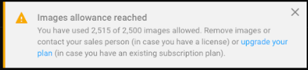
- Pop up message when a user is reaching the end of the allowance
- [PIX4Dcloud only] Direct access to PIX4Dcloud Advanced trial license through the account menu for users with access to PIX4Dcloud
Bug fixes
- [PIX4Dcloud Advanced] Fixed the issue with having decimals in the GCP target size (it did not process)
- Fixed the issue where units were not properly taken when sharing a project
- Fixed the issue with the start process button which could be clicked more than once and that was causing projects to fail.
- Fixed the issue with importing a zipped point cloud. The uploader got stuck.
- [PIX4Dcloud Advanced] Fixed the issue when going back to the editor after using the compare mode, two orthos and two DSMs were displayed in the same project
Changes
- [PIX4Dcloud Advanced] Disable annotations in compare mode
July 3rd, 2020 - Processing templates, bug fixes and improvements
What's new
- Processing template selection
Improvements
- [PIX4Dcloud Advanced] Overlay import allows zooming as much as needed
- Welcome dialog has been removed and a new login icon has been added
- Better support for Microsoft Edge browser
- User interface improvements: better contrast in the uploader, better contrast in the drop area in the wizard, improved files view for mobile users
- PIX4Dcloud favicon added
Bug fixes
- [PIX4Dcloud Advanced] Compare mode: fix to show the compare button in shared projects, fix to solve an issue with the second project not refreshing correctly
- [PIX4Dcloud Advanced] GCP report can be opened in Acrobat Reader
- Fixed the issue where units were not taken properly from the account settings
- Fixed the export button in the Virtual Inspector
- Fix to inform the user when a .zip file is being prepared for download
June 9th, 2020 - Launch release
What's new
- PIX4Dcloud and PIX4Dcloud Advanced are standalone products and can be purchased separately from PIX4Dmapper.
- New UI with respect to the old Cloud platform
- PIX4Dcloud Drive to better organize, view and filter the projects
- Guided procedure for project and site creation
- 2D and 3D synchronized views displaying DSM, orthomosaic, NDVI map, Point Cloud and 3D Textured Mesh
- Markers, measurements, volume calculations exchangeable between projects and third-party software
- Adjustable layer hierarchy
- Sharing functionality with view and measure or edit and save rights
- Dedicate view for downloadable input and output files
- [PIX4Dcloud Advanced] Visualization of the evolution of the site through a Timeline.
- [PIX4Dcloud Advanced] AutoGCPs detection functionality. Our AI algorithm finds and marks the GCPs for you during the processing phase
- [PIX4Dcloud Advanced] CAD overlays to easily import and overlay design plans and maps. The as-built can be quickly compared with the as-designed to easily check progress and identify as-built errors
- [PIX4Dcloud Advanced] 2D comparison (shareable) view
- [PIX4Dcloud Advanced] Volume comparison and monitoring report