IN THIS ARTICLE
Working with GCPs with PIX4Dmapper
Working without GCPs with PIX4Dmapper
Special characteristics of PIX4Dcloud projects with arbitrary systems
Limitations of projects with arbitrary systems
Licenses: This feature is available to PIX4Dcloud Starter and PIX4Dcloud Pro licenses.
Roles: Only Owners, Managers, and Editors can create a dataset.
Working with GCPs using PIX4Dmapper
- In PIX4Dmapper, create a project. Import the images and configure the image properties. More information in Step 2. Creating a Project.
- Select Arbitrary as output coordinate system.
- Import the GCPs and define the GCP coordinate system as Arbitrary.
- Mark the GCPs by using the Basic GCP/MTP Editor.
- Once the GCPs have been marked, upload the project to be processed on PIX4Dcloud.
Working without GCPs using PIX4Dmapper
- Compute the seven parameters transformation from WGS84 to the user-defined coordinate system as explained in How to compute the Site Calibration for GCPs in an Arbitrary Coordinate System.
- In PIX4Dmapper, create a new project.
- As output coordinate system, select Arbitrary and apply the seven parameters transformation computed at step 1 (more information in How to use the Site Calibration Parameters).
- Upload the project to be processed on PIX4Dcloud.
Special characteristics of PIX4Dcloud projects with arbitrary systems
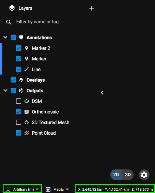
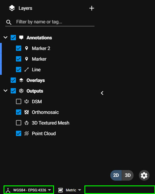
- The coordinate system is defined as Arbitrary (units) in the 2D/3D view.
- No WGS84 latitude, longitude coordinates are displayed in the 2D/3D view.
- As the coordinates are arbitrary, there is no OpenLayers map as background.
- Unlike other projects with standard coordinate systems, the annotations are exported in that arbitrary system and not in WGS84 (latitude, longitude).
Limitations of projects with arbitrary systems
The AutoGCPs detection functionality does not support arbitrary systems.