地形フィルター処理は、選択された入力点群を指定された処理値に基づき、地形と非地形に分類します。 これらのクラスは、後の処理ステップで使用することができます。たとえば、地形クラスのみから点群グリッドを作成することができます。

アクセス
- 処理
 アイコンをクリックします。
 - または、メニュー バーの [処理] > [地形フィルター] をクリックします。
- または、[コンテンツ] パネルで[地形クラス] > [処理] をクリックします。
処理オプション
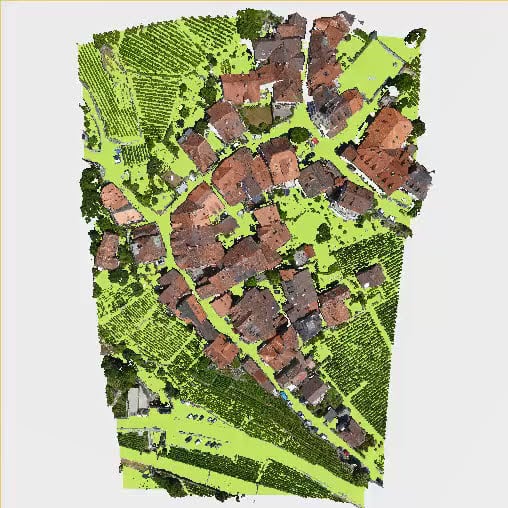
入力点群
地形フィルター処理で使用される点群を定義します。
- All (すべて) - 既定: [コンテンツ] > [点群] のすべての点群が処理に使用されます。
- Only visible (表示のみ): [コンテンツ] > [点群] で表示されている点群のみが処理に使用されます。
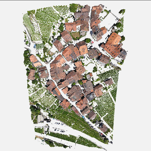
例: [Only visible (表示のみ)] オプションを選択すると、表示された点群 [1] のみが処理に使用されます。非表示の点群 ( ) は処理に使用されません。

サンプル距離
- サンプル距離 [単位]: アルゴリズムのサンプリング グリッド サイズを決定します。 範囲は、プロジェクトの座標系の単位によって異なります。
- 5.0 m - 0.5 m、1.0 m - 既定。
- 15.0 ft - 1.5 ft、3.0 ft - 既定。
例: [サンプル距離] パラメーターの正しい値設定は、入力点群の特性に大きく依存します。
- 大きなサンプル距離: 単純で平坦なエリアまたは密度の低い点群に適しています。
- 小さいサンプル距離: 地形の標高が急激に変化するエリアや建物が多いエリアに適しています。 サンプル距離を小さくすることで、地形からより詳細な情報を検出できます。
注: [サンプル距離] パラメーターは、処理時間に直接影響します。 小さい値 (例: 0.5 mまたは1.5フィート) に設定すると処理時間が長くなることがあります。
硬直性
- 硬直性 ([低] - 既定、[中]、[高]): 地形をシミュレートするファブリックの物理パラメーターです。 硬直性が低いと柔らかく、ドレープしやすくなり、硬直性が高いと硬くなり、ドレープのたわみが少なくなります。
地上閾値
- 地上閾値 [単位] (0.5 m、1 ft - 既定): 入力点群のポイントと、[サンプル距離] パラメーターと [硬直性] パラメーターに基づいて生成されたサーフェスとの間の最大許容距離を決定します。 最適な値は、点群の元の密度と再構成の品質に依存します。
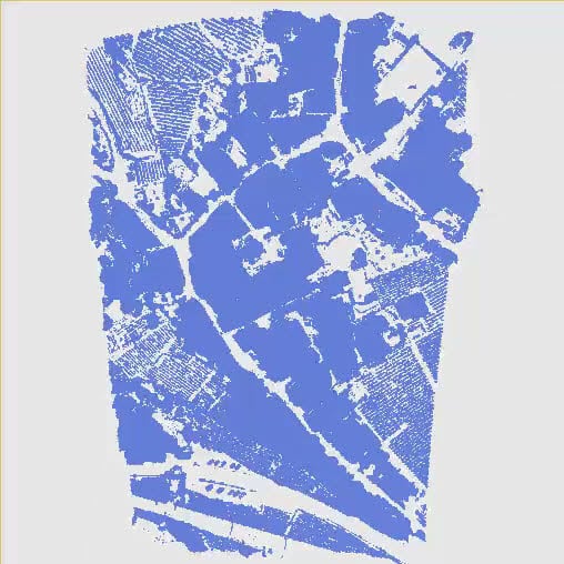
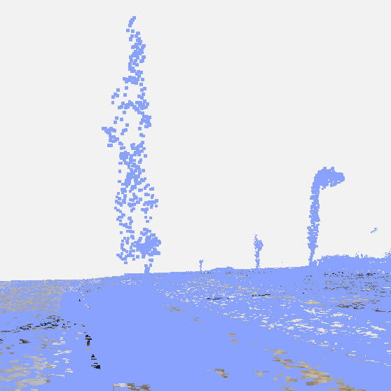
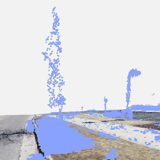
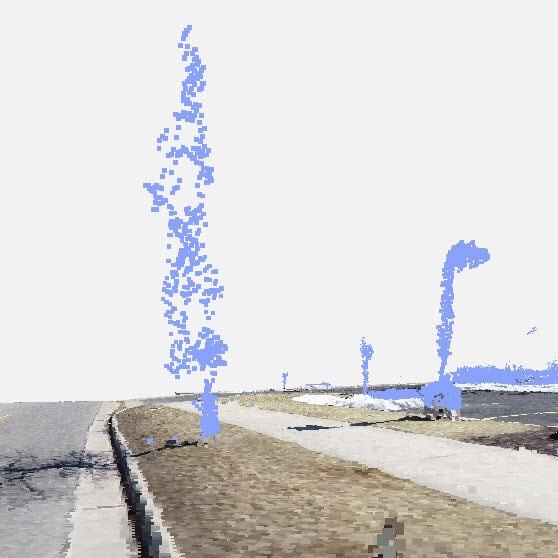
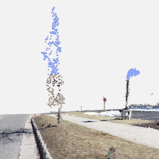
例: [地上閾値] の値を小さくすると、地面に近いポイントが非地形クラス (青色) に含まれます。
結果
アクセス: [地形フィルター] の処理の結果は、[コンテンツ] >  [地形クラス] パネルで確認できます。
次の地形クラスが利用可能です。
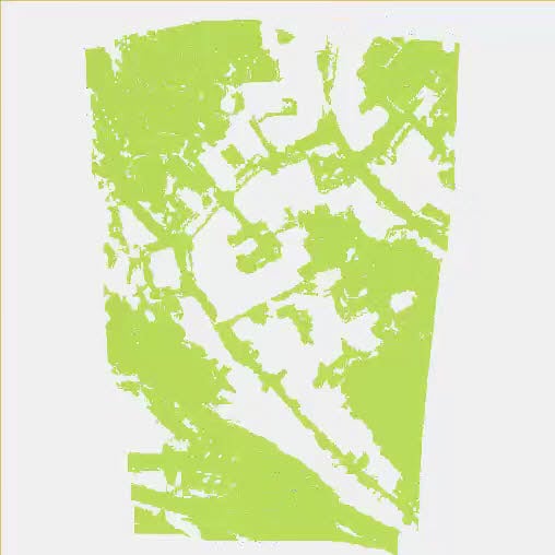
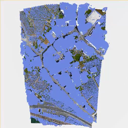
- [非地形] (青色): 地形以外として分類されるポイントです。
- [地形] (緑色): 地形として分類されるポイントです。
- [未分類]: 一度も分類されなかった点群に対応するポイントです。
地形クラスを表示するには、[点群] と [地形クラス] の両方を表示 (![]() ) する必要があります。
) する必要があります。
[点群] セクションでポイントが非表示になっている場合、地形クラスの表示が上書きされます。
地形クラスの色表示を変更するには以下の手順に従います。
- モノクロ (既定) の場合は、[モノクロでクラスを表示]
 をクリックします。
 - RGB の場合は、 [RGBでクラスを表示]
 をクリックします。