IN THIS ARTICLE
What is a region of interest?
How to draw a region of interest
How to edit the region of interest
How to delete the region of interest
Viewing the region of interest with GCPs
Limitations
Licenses: This article is valid for all PIX4Dcloud licenses.
Roles: Only Owners, Managers, and Editors can create and process datasets in PIX4Dcloud.
What is a region of interest?
A region of interest is a polygon drawn after importing images but before processing. It defines the area where the outputs (Orthomosaic, DSM, 3D mesh, and point cloud) will be generated. Using a ROI can reduce processing time and improve result quality.
Informations:
-
The ROI is not used for calibration, so credit consumption remains the same with or without it.
-
If the ROI does not overlap with the area captured by images, processing will fail.
-
Images outside the ROI but capturing elements inside the ROI will contribute to the outputs.
How to draw a region of interest
-
Create a dataset and import the images.
-
Once the images are displayed on the map, click Region of interest.
-
Click on the map to define each vertex of the polygon.

- Double-click or click the first vertex to complete the polygon.
- Click Next to continue creating the dataset.
How to edit the region of interest
-
Click inside the ROI; it will be highlighted in blue.

-
Move a vertex by clicking and dragging it.
-
Add new vertices by clicking anywhere on the border.
-
Delete a vertex by pressing Alt and clicking the vertex.
-
Click outside the ROI to save the changes.
How to delete the region of interest
Click Remove region of interest to delete the polygon.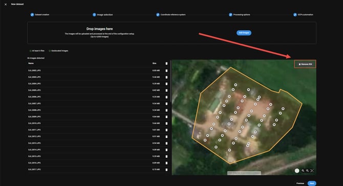
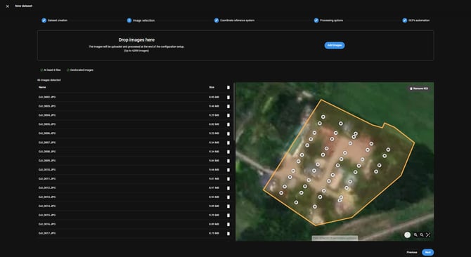
Viewing the region of interest with GCPs
If GCPs are imported before processing, the ROI can be visualized together with them during the GCPs Automation step. The ROI does not need to cover all control points; AutoGCP will detect and use control points even if they are outside the ROI.
Limitations
-
Interior polygons, holes, or multi-part polygons are not supported in the PIX4Dcloud web interface. However, the PIX4Dcloud Enterprise with API access allows datasets with these polygon types. More information: projects_processing_options_create.
-
Shapefiles or other external files cannot be used as a ROI.