Menu View > Volumes - PIX4Dmapper
This article explains the main features displayed in the Volumes window in PIX4Dmapper.
Access: On the Menu bar, click
View > Volumes.
The use of Volumes is optional. It can be used to:
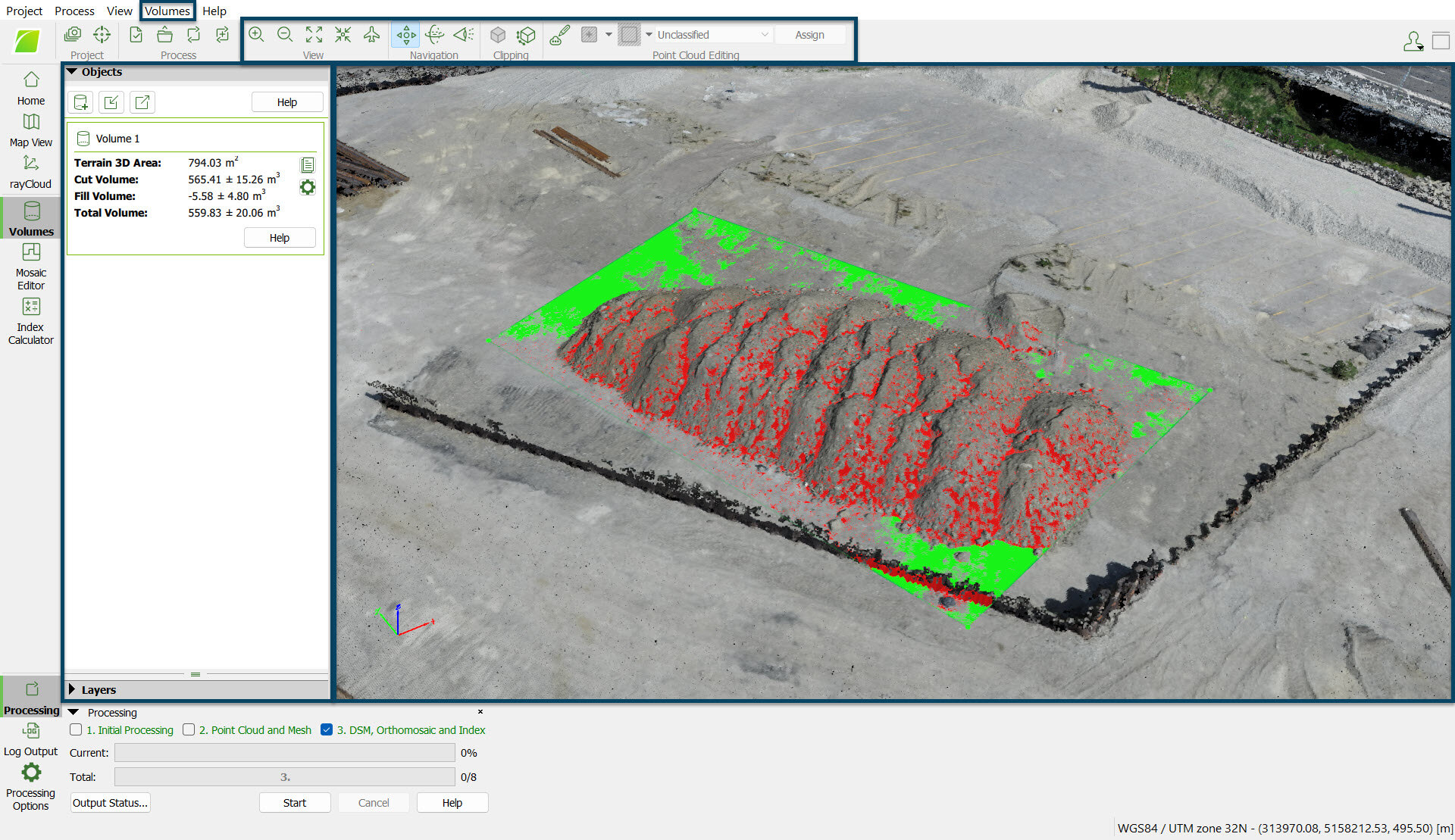
- Draw and visualize volumes.
- Measure volumes.
- Import and Export volumes.
When selecting the Volumes view, the following elements are displayed on the main window:
- Menu bar entry: The standard Menu bar items and an extra item.
- Toolbar: The standard toolbar and some extra buttons specific to the rayCloud and the Volumes view.
- 3D View: Displayed in the main window. It is a simplified version of the rayCloud 3D View. Displays in 3D the different elements.
- Sidebar: Displayed on the left of the Volumes view.
- Status bar: Displayed on the bottom right of the Volumes view. Displays the coordinates when passing the mouse over any element displayed in the 3D View.
On the bottom right part of the 3D View, the following is displayed:
![]()
- Selected Coordinate System: Displays the selected coordinate system of the point.
- Position: Displays the (X,Y, Z) coordinates in meters [m] / feet [ft] of each point of the 3D View when passing the mouse over any element. When passing the mouse over the displayed elements, the coordinates change.
Important: In the Volumes, the coordinate system is the output coordinate system.
By default the output coordinate system is the same as the GCPs coordinate system if GCPs are used. Otherwise, it is the same as the image geolocation coordinate system. If the coordinates system is WGS84, the output is given in UTM. If less than 3 images are geolocated, and less than 3 GCPs are defined, the output coordinates system is set to "Arbitrary".
By default the output coordinate system is the same as the GCPs coordinate system if GCPs are used. Otherwise, it is the same as the image geolocation coordinate system. If the coordinates system is WGS84, the output is given in UTM. If less than 3 images are geolocated, and less than 3 GCPs are defined, the output coordinates system is set to "Arbitrary".