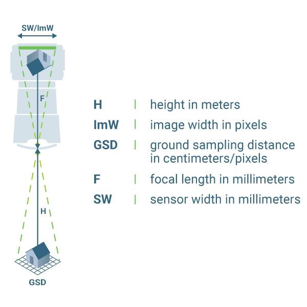
The Ground Sampling Distance (GSD) is the distance between two consecutive pixel centers measured on the ground. The bigger the value of the image GSD, the lower the spatial resolution of the image and the less visible details.
The GSD is calculated based on:
- The flight height / the distance from the terrain or object (H).
- The camera specifications:
- Image width (ImW).
- Sensor width (SW).
- Focal length (F)
- Automatic tool for GSD calculation: TOOLS - GSD calculator.
- How to select camera focal length and flight altitude considering the desired Ground Sampling Distance and terrain to map: How to select Camera Focal Length and Flight Altitude considering the desired Ground Sampling Distance and Terrain to map? - PIX4Dmapper.
- Can images taken at different flight heights be processed?: How to process images taken at different Flight Heights / GSD? - PIX4Dmapper.
It is important to decide on the GSD value before starting the image acquisition in order to adjust the flight height and the camera specifications to the project requirements. For example, when a detailed reconstruction of the area is needed, we recommend flying closer (low GSD) to the object of interest. On the other hand, when covering large areas that do not need very detailed results, flying higher (high GSD) can greatly reduce the acquisition time and batteries needed as well as to reduce the processing time.
- A GSD of 5 cm means that one pixel in the image represents linearly 5 cm on the ground (5*5 = 25 square centimeters).
- A GSD of 30 cm means that one pixel in the image represents linearly 30 cm on the ground (30*30 = 900 square centimeters)

