Pix4Dmatic can generate and export three different point clouds. A Depth point cloud, a Dense point cloud, and a Depth & dense fused point cloud. Each one uses different input data to create it along with having different attributes.
Dense point cloud
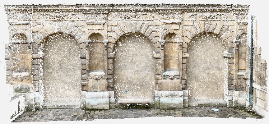
A dense point cloud is generated from images using photogrammetry. Imagery with sufficient quality, overlap, and texture can generate very dense and highly accurate point clouds. Accuracy and density are the strengths of this process. Homogenous regions containing little to no texture will produce areas of less density.
For more information: Dense point cloud - PIX4Dmatic.
Depth point cloud
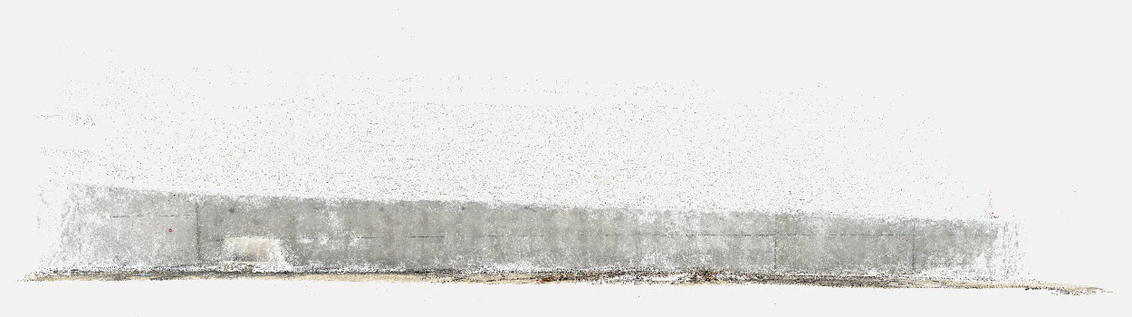
The depth point cloud is generated with DepthMap files from LiDAR-capable iPhone and iPad devices captured with PIX4Dcatch. LiDAR (Light Detection And Ranging) is a measuring system that uses light by sending out light pulses and measuring how long the pulses take to return to the scanner. The strengths of LiDAR when generating 3D models include highly accurate measurements from the device to the subject which can help estimate a more accurate scale of the reconstruction, as well as, being able to capture data from homogenous and low-texture surfaces.
For more information: Depth point cloud - PIX4Dmatic.
Depth & dense fused point cloud
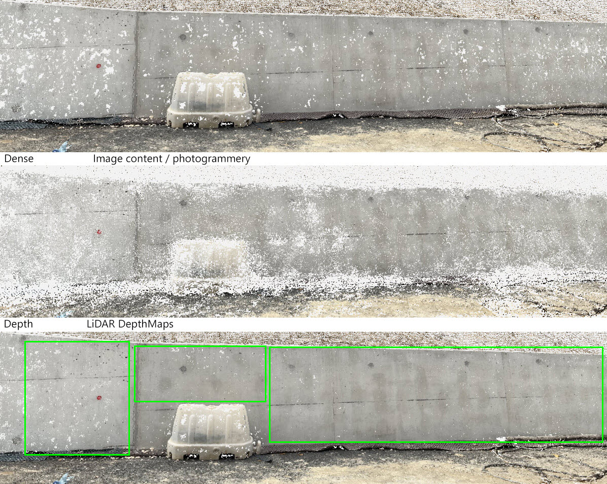
The Depth & dense fusion option combines the dense point cloud with the depth point cloud, leveraging the strengths from each input allowing for a better point cloud. PIX4Dmatic can take the more accurate geolocation and orientation data when generating the Dense point cloud and apply it to the LiDAR data which can be misaligned by GPS and IMU drift inherent in mobile devices. The correctly located and oriented LiDAR data allows PIX4Dmatic to fill the gaps in the homogenous and low-texture areas creating a denser more complete point cloud.
PIX4Dmatic allows for the adjustment of tolerances between the two in the fusion process. For more information: Depth and dense fusion - PIX4Dmatic
For more information on How to process PIX4Dcatch datasets in PIX4Dmatic.