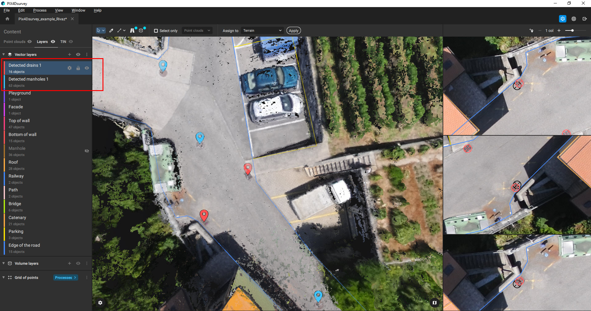
The automated feature extraction algorithm detects manholes, drains, and poles from images.
Access: This feature is available only for projects processed in
PIX4Dmapper or
PIX4Dmatic. Images need to be available for the algorithm to run.
Note: The automatic object detection can take several minutes to several hours, depending on the project's size and used hardware.
To run the automatic feature extractions:
- Click Automatic feature extraction
 .
. - Select the object:
- Manholes.
- Drains.
- Poles.
- Click Detect object.
Video: Detecting and vectorizing poles in large areas for mapping cities and their infrastructure networks is a laborious effort. With #PIX4Dsurvey you can now detect poles in images automatically and create markers for every pole that can be exported in multiple formats to CAD!
Tip: To improve the quality of the automatic detection, run the terrain filter first. Then the detection will be applied only to terrain points.
Tip: The processing speed can be improved by allowing PIX4Dsurvey to use a discrete graphics card. For more information:
How to set PIX4Dsurvey to use a discrete graphic card (Windows 10).
Once the automatic feature extraction is completed objects are available in new layers in the Content - Layers panel and it is possible to visualize them in the project.