IN THIS ARTICLE
Supported use cases
Currently, AutoGCP supports:
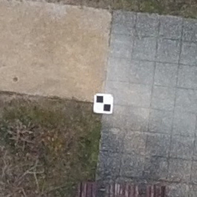
- Three kinds of targets: square, diagonal, and AeroPoint.
- Automatic detection is currently supported only on RGB images.
- The recommended size is a minimum of 20 times the average GSD of the project.
Example: If the average GSD of the projects is 2.5 cm (1 inch), the recommended target size is 50 cm (20 inches).
- Black and white targets are supported. Other colors may work in some circumstances.
- GCPs must be placed at a distance of at least 10 m from each other.
- GCPs must have a projected coordinate system.
- Both nadir and oblique flights.
Note: The algorithm is able to detect targets on slightly oblique projects (required: 0° - 45°; recommended: 10° - 35°). We do not recommend tilting the camera too much or placing targets outside the mission.


Best practices
AutoGCP algorithm is robust to variations in scale and rotation and can work on different types of ground control points. Optimal results are obtained following these guidelines:
- The targets on the ground should be placed sufficiently distant from each other. The spacing should be at least larger than the camera georeferencing horizontal uncertainty.
- Images should not be blurry or faded, and the targets should be clean.
- GCPs should be located in locations with sufficient contrast between the target and the ground.
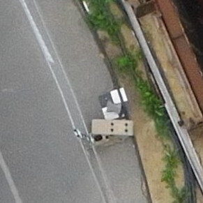
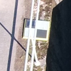
- The target should not be obstructed by any object above it or by shadows.
Example: Some examples below show potentially problematic targets for detection.

- If obstruction cannot be avoided, more targets than necessary can be used, to increase the chances that a sufficient number of targets is available for re-calibration or re-optimization even if some are not detected.
- The target must be large enough in order to be visible in the images.
Example: As a rule of thumb, the diagonal of the target should be approximately 20 pixels, but this number may vary depending on the image quality (e.g., blur, exposure, contrast). For example, if the average GSD of the projects is 2.5 cm (1 inch), the recommended diagonal of the target is 50 cm (20 inch).
- Good image overlap makes the AutoGCPs results more reliable, with each target visible in multiple images.
- Only the targets in use should be visible. If unused targets are visible in the images, AutoGCPs can be misled.
AutoGCP algorithm is implemented in:
- PIX4Dcloud Advanced, an online platform for drone mapping, progress tracking, and site documentation.
- PIX4Dengine, customizable photogrammetry reconstruction engine.
- PIX4Dmatic, photogrammetry software for corridor and large-scale mapping.
PIX4Dcatch: This feature is available for black & white checker tags used in nadir data acquisition. For PIX4Dcatch this feature will not work, instead it is recommended to use the AutoTag feature.