IN THIS ARTICLE
Accessing the Drive
Drive Map View
Navigating the map
Drive content
Switching Drive view
Credits
Licenses: This article is valid for all PIX4Dcloud licenses.
Roles: Owners, Managers, Editors, and Readers can see all resources in Drive that belong to the Organization in PIX4Dcloud.
Video: The following video tutorial explains step-by-step how to organize folders and projects in PIX4Dcloud.
Accessing the Drive
The Drive can be accessed in the following ways:
-
Go to https://cloud.pix4d.com and select Log in.
-
From the 2D/3D view, select PIX4Dcloud Drive in the top-left corner.

Drive Map View
The Map View is the default Drive view. It displays geolocated datasets and sites on an interactive map and provides access to Drive navigation and management tools.
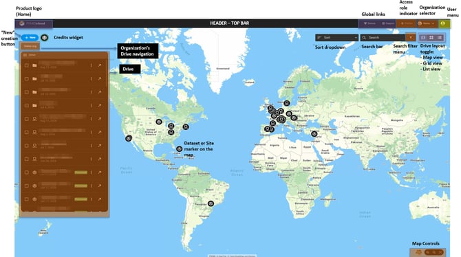
- Organization selector: Switch between Organizations when applicable.
- User menu: Access license information, account settings, language and theme preferences, product updates, and logout.
- Search: Find datasets, sites, or folders by name.
- Sort: Sort resources by name or date.
- Drive panel: View and manage datasets, sites, and folders.
- Credits: View the available processing credit balance.
- Demos / Support: Access Demo datasets and PIX4D Support.
Navigating the map
Use the controls in the lower-right corner of the map to:
- Switch between Map and Satellite views.
- Zoom in or Zoom out.
- Select Zoom to all to display all datasets and sites currently listed in the Drive panel.
To locate a resource, select its marker on the map or search for it using the Search field. The map centers on the resource and highlights it in the Drive panel.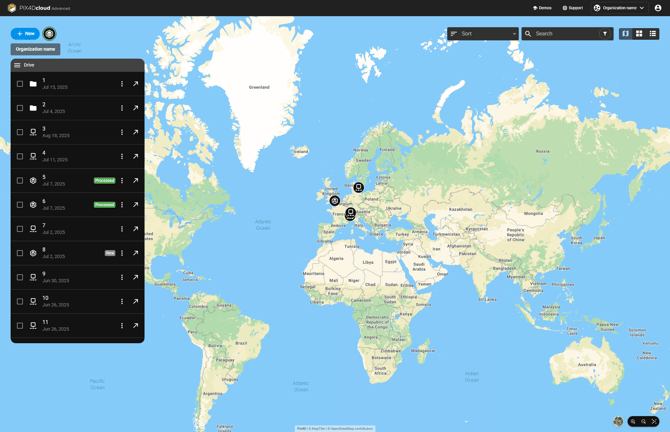
Resource positioning
- Datasets are positioned using the geographic center of their georeferenced outputs.
- Sites are positioned using the geographic center of the most recently added dataset in the site.
Datasets and sites without geolocation cannot be displayed on the map but remain available in the Drive panel.
Information: Datasets and sites stored in closed folders are not displayed on the map. Open the folder to display its contents.
Drive content
The Drive contains three main types of resources:
- Dataset: Represents data collected at a specific location and time.
- Site: Groups datasets acquired at the same location over different time periods. Available with PIX4Dcloud Pro and above.
- Folder: Organizes datasets and sites and can contain other folders.
For more information, see:
Deleting resources
- Select one or more datasets, sites, or folders.
- Select Delete.
- Type DELETE to confirm.
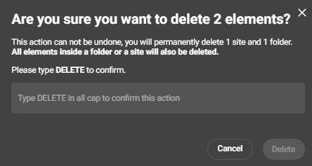
Warning: Deletion is permanent. Deleting a folder or site also deletes its contents.
Switching Drive views
The Drive content can be displayed using:
 Map View: Displays geolocated datasets and sites on an interactive map.
 Card View: Displays folders, datasets, and sites as cards.
 List View: Displays folders, datasets, and sites in a table with information such as name, creation date, and status.
Information: Advanced site-based workflows and timeline functionality are available with PIX4Dcloud Pro.
Credits
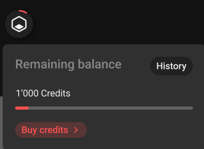
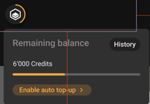
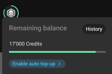
Hover over the Credits icon in the top-left corner of the Drive to view the available processing credits.
The credit indicator shows whether the balance is:
- Less than 50 credits
- 50–100 credits
- More than 100 credits