The following is available:
- A General report is generated after running the Calibrate or Reoptimize step:
- Click the Report
 panel.
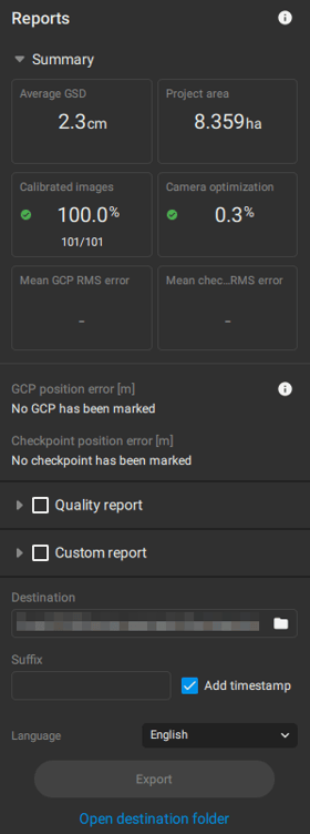
- Click the Report
- Detailed quality report (.pdf). To export the detailed quality report:
- In the Report panel, Check the Quality Report checkbox, then click Export.
- In the Processing options panel, check Exports - Quality report.
- On the Menu bar > File, click Export quality report...
IN THIS ARTICLE
Quality ReportHeader
Project Summary
Quality check
Cameras
Internal Camera Parameters
Absolute geolocation variance
Camera positions
Overlap
2D Keypoint Matches
Tie points
Ground control points (GCPs)
Checkpoints (CPs)
Manual tie points (MTPs)
Manual checkpoints (MCPS)
Manual intersection tie points (mITPs)
Vertex tie points (VTPs)
DSM
Orthomosaic
Hardware and settings
System information
Coordinate reference systems
Processing settings
Calibration
Depth point cloud
Dense point cloud
Depth and dense
Planes
Mesh
Digital Surface Model (DSM)
Orthomosaic
The following table describes the content of the quality report.
Note: The quality export can be generated in different languages: English, Spanish, French, Chinese simplified, Japanese, Korean, Chinese traditional, German, Portuguese, Turkish, Czech, Ukrainian.
Quality Report
| Header | |
|---|---|
| Date | The date the project was processed. |
| Project name | The name of the project. |
| Version | The version of the software used to process the project. |
| Project summary | |
| Cameras | The name of the camera model(s) used to capture the images. |
| Area covered | The estimated project area. |
| Average GSD | The average GSD of the initial images. For more information: Ground sampling distance (GSD). |
| Project CRS (coordinate reference system) |
The horizontal and vertical coordinate system used for processing. When the vertical coordinate reference system is not specified, the base ellipsoid of the horizontal coordinate is used. |
| Dense point count |
The number of points in the Dense point cloud of the project. |
| Quality check | |
| Matches |
The median of matches per calibrated image.
|
| Dataset |
The percentage of images that have been calibrated as well as the number of images that have been used for the reconstruction of the model with respect to the total number of the images in the project.
|
| Camera optimization | The percentage of the difference between initial and optimized focal length of the camera.
|
| GCPs (optional) | Displays the number of imported GCPs, the Mean RMS position error of the marked GCPs, and their Sigma value.
|
| Checkpoints (optional) | Displays the number of added Checkpoints, the Mean RMS position error of the marked Checkpoints and their Sigma value.
|
| MTPs (optional) | Displays the mean projection error.
|
| aITPs (optional) | Displays the mean projection error.
|
| mITPs (optional) | Displays the mean projection error.
|
| ATPs (optional) | Displays the mean projection error.
|
| VTPs (optional) | Displays the mean projection error.
|
Cameras

Absolutely geolocation variance
|
Absolutely geolocation variance |
The geolocation error is the difference between the initial and computed camera positions. Plots show the per-axis distributions of geolocation errors across the cameras. Large positive and negative errors are denoted with the orange bins. Note that the image geolocation errors do not correspond to the accuracy of the observed 3D points. |
| Geolocation error X [units] |
Mean: The mean / average geolocation error in the X-axis. Median: The middle value of the errors across all values in the X-axis individually when arranged in ascending order. Sigma: The standard deviation of the error in the X-axis. RMS: The Root Mean Square error in the X-axis. |
| Geolocation error Y [units] |
Mean: The mean / average geolocation error in the Y-axis. Median: The middle value of the errors across all values in the Y-axis individually when arranged in ascending order. Sigma: The standard deviation of the error in the Y-axis. RMS: The Root Mean Square error in the Y-axis. |
| Geolocation error Z [units] |
Mean: The mean / average geolocation error in the Z-axis. Median: The middle value of the errors across all values in the Z-axis individually when arranged in ascending order. Sigma: The standard deviation of the error in the Z-axis. RMS: The Root Mean Square error in the Z-axis. |

Camera positions

| Overlap | |
| Graph |  |
| Description | This graph shows the number of overlapping images for each pixel of the DSM preview. For precises 3d modeling and mapping applications, the overlap in the area of interest should be green, i.e. each pixel should be visible in more than 5 images. |
Matches

Tie points
| Ground control points (GCPs) | |
|---|---|
| Label | The name of the GCP. |
| Position error - X[m or ft] | The difference between the computed and the initial position of the ground control point in the X-axis, i.e., computed position - initial position. |
| Position error - Y[m or ft] | The difference between the computed and the initial position of the ground control point in the Y-axis, i.e., computed position - initial position. |
| Position error - Z[m or ft] | The difference between the computed and the initial position of the ground control point in the Z-axis, i.e., computed position - initial position. |
| Reprojection error [px] |
The average distance in the images where the GCP has been marked and where it has been re-projected. |
| Accuracy - X/Y [m or ft] | The Accuracy X/Y of the GCP that has been given in this project in XY direction. |
| Accuracy - Z [m or ft] | The Accuracy Z of the GCP that has been given in this project in Z direction. |
| Verified/Marked | Verified: The number of images on which the GCP has been marked and are taken into account for the reconstruction. Marked: The images on which the GCP has been marked. |
| Mean | The mean / average position error in each direction (X,Y,Z). For more information: How are the GCP Errors defined in the Quality Report?. |
| Median | The middle value of the errors across all GCPs in each direction (X, Y, Z) individually when arranged in ascending order. |
| Min | The minimum error across all GCPs in each direction (X,Y,Z) individually. |
| Max | The maximum error across all GCPs in each direction (X,Y,Z) individually. |
| RMS | The Root Mean Square error in each direction (X,Y,Z). For more information: How are the GCP Errors defined in the Quality Report?. |
| Sigma | The standard deviation of the error in each direction (X,Y,Z). For more information: How are the GCP Errors defined in the Quality Report?. |
| Checkpoints (CPs) | |
|---|---|
| Label | The name of the checkpoint. |
| Position error - X[m or ft] | The difference between the computed checkpoint and the original position in X direction (computed position - initial position). |
| Position error - Y[m or ft] | The difference between the computed checkpoint and the original position in Y direction (computed position - initial position). |
| Position error - Z[m or ft] | The difference between the computed checkpoint and the original position in Z direction (computed position - initial position). |
| Reprojection error [px] |
The average distance in the images where the checkpoint has been marked and where it has been re-projected. |
| Accuracy - X/Y [m or ft] | The Accuracy X/Y of the checkpoint that has been given in this project in XY direction. |
| Accuracy - Z [m or ft] | The Accuracy Z of the checkpoint that has been given in this project in Z direction. |
| Verified/Marked | Verified: The number of images on which the checkpoint has been marked and are taken into account for the reconstruction. Marked: The images on which the checkpoint has been marked. |
| Mean | The mean / average position error in each direction (X,Y,Z). For more information: How are the GCP Errors defined in the Quality Report?. |
| Median | The middle value of the errors across all checkpoints in each direction (X, Y, Z) individually when arranged in ascending order. |
| Min | The minimum error across all checkpoints in each direction (X,Y,Z) individually. |
| Max | The maximum error across all checkpoints in each direction (X,Y,Z) individually. |
| RMS | The Root Mean Square error in each direction (X,Y,Z). For more information: How are the GCP Errors defined in the Quality Report?. |
| Sigma | The standard deviation of the error in each direction (X,Y,Z). For more information: How are the GCP Errors defined in the Quality Report?. |
| Manual tie points (MTPs) | |
|---|---|
| Label | The name of the MTP. |
| Reprojection error [px] |
The average distance in the images where the MTP has been marked and where it has been re-projected. |
| Verified/Marked | Verified: The number of images on which the MTP has been marked and are taken into account for the reconstruction. Marked: The images on which the MTP has been marked. |
| Mean | The mean/average position error in each direction (X,Y,Z). For more information: How are the GCP Errors defined in the Quality Report?. |
| Median | The middle value of the errors across all MTPs individually when arranged in ascending order. |
| Min | The minimum error across all checkpoints in each direction (X,Y,Z) individually. |
| Max | The maximum error across all checkpoints in each direction (X,Y,Z) individually. |
| RMS | The Root Mean Square error in each direction (X,Y,Z). For more information: How are the GCP Errors defined in the Quality Report?. |
| Sigma | The standard deviation of the error in each direction (X,Y,Z). For more information: How are the GCP Errors defined in the Quality Report?. |
| Manual checkpoints (MCPs) | |
|---|---|
| Label | The name of the MCP. |
| Reprojection error [px] |
The average distance in the images where the MCP has been marked and where it has been re-projected. |
| Verified/Marked | Verified: The number of images on which the MCP has been marked and are taken into account for the reconstruction. Marked: The images on which the MCP has been marked. |
| Mean | The mean/average position error in each direction (X,Y,Z). For more information: How are the GCP Errors defined in the Quality Report?. |
| Median | The middle value of the errors across all MCPs individually when arranged in ascending order. |
| Min | The minimum error across all checkpoints in each direction (X,Y,Z) individually. |
| Max | The maximum error across all checkpoints in each direction (X,Y,Z) individually. |
| RMS | The Root Mean Square error in each direction (X,Y,Z). For more information: How are the GCP Errors defined in the Quality Report?. |
| Sigma | The standard deviation of the error in each direction (X,Y,Z). For more information: How are the GCP Errors defined in the Quality Report?. |
| Manual intersection tie points (mITPs) | |
|---|---|
| Label | The name of the mITP. |
| Reprojection error [px] |
The average distance in the images where the mITP has been marked and where it has been re-projected. |
| Verified/Marked | Verified: The number of images on which the MTP has been marked and are taken into account for the reconstruction. Marked: The images on which the MTP has been marked. |
| Mean | The mean/average position error in each direction (X,Y,Z). For more information: How are the GCP Errors defined in the Quality Report?. |
| Median | The middle value of the errors across all mITPs individually when arranged in ascending order. |
| Min | The minimum error across all checkpoints in each direction (X,Y,Z) individually. |
| Max | The maximum error across all checkpoints in each direction (X,Y,Z) individually. |
| RMS | The Root Mean Square error in each direction (X,Y,Z). For more information: How are the GCP Errors defined in the Quality Report?. |
| Sigma | The standard deviation of the error in each direction (X,Y,Z). For more information: How are the GCP Errors defined in the Quality Report?. |
| Vertex tie points (VTPs) | |
|---|---|
| Label | The name of the VTP. |
| Reprojection error [px] |
The average distance in the images where the VTP has been marked and where it has been re-projected. |
| Verified/Marked | Verified: The number of images on which the VTP has been marked and are taken into account for the reconstruction. Marked: The images on which the VTP has been marked. |
| Mean | The mean/average position error in each direction (X,Y,Z). For more information: How are the GCP Errors defined in the Quality Report?. |
| Median | The middle value of the errors across all VTPs individually when arranged in ascending order. |
| Min | The minimum error across all checkpoints in each direction (X,Y,Z) individually. |
| Max | The maximum error across all checkpoints in each direction (X,Y,Z) individually. |
| RMS | The Root Mean Square error in each direction (X,Y,Z). For more information: How are the GCP Errors defined in the Quality Report?. |
| Sigma | The standard deviation of the error in each direction (X,Y,Z). For more information: How are the GCP Errors defined in the Quality Report?. |
Digital Surface Model (DSM)
| DSM | |
|---|---|
| Image |
|
| Description |
Image of the Digital Surface Model (DSM) created after the DSM step is completed. |


Hardware and settings
Processing settings
| Calibration | |
|---|---|
| Template |
It shows the template that can be selected according to the dataset imported for processing:
For more information see Calibration - PIX4Dmatic. |
| Pipeline |
It shows the pipeline that can be selected according to the dataset used for processing:
For more information see Calibration - PIX4Dmatic. |
| Image scale | The value of the image scale used for keypoints extraction.
For more information, see Processing options - Image Scale. |
| Max extracted keypoints |
For more information, see Processing options - Keypoints. |
| Internals confidence |
For more information see Processing options - Internals confidence. |
| Automatic ITPs Reoptimized |
When enabled PIX4Dmatic generates and matches structural line intersections between images:
For more information, see Automatic ITPs - PIX4Dmatic |
| Duration | The time needed for processing the Calibrate step. |
| Reoptimization | |
| Rematch |
When enabled PIX4Dmatic computes more matches between images and optimizes the internal and external camera parameters:
|
| Camera internals | Optimized or not optimized depending on the Reoptimization settings |
| Duration | The time needed for the Reoptimization. |
| Depth point cloud | |
| Duration | The time needed for processing the Depth point cloud step. |
| Dense point cloud | |
| Algorithm |
For more information, see Algorithm - Dense point cloud - PIX4Dmatic. |
| Image scale |
For more information, see Processing options - Image scale. |
| Multiscale |
For more information, see Processing options - Multiscale. |
| Density | Defines the density of the point cloud:
For more information, see Processing options - Density. |
| Min number of matches | Minimum Number of Matches (2-6, 3 default) represents the minimum number of valid re-projections of this 3D point to the images.
For more information, see Processing options - Minumum matches. |
| Noise filter |
For more information, see Processing options - Noise filter. |
| Sky filter |
For more information, see Processing options - Sky filter. |
| Duration | The time needed for processing the Densify step. |
| Depth & dense fusion | |
| Distance | Minimum distance from a depth point to the dense point cloud for fusing it. |
| Duration | The time needed for processing the Depth & dense fusion step. |
| Mesh | |
| Input point cloud* |
It defines which point cloud is selected as the input point cloud for the Mesh generation:
For more information, see Processing options - Input point cloud. |
| Template |
It shows the template that can be selected according to the different types of datasets imported for processing:
For more information, see Processing options - Template. |
| Texture size |
Texture Size (1024x1024 - 32768x32768 pixels, default 8192x8192 pixels). For more information, see Processing options - Texture size. |
| Deghosting |
This option can be used for soft or aggressive outlier detection. It can be useful for complex geometries during mesh creation:
For more information, see Processing options - Deghosting. |
| Decimation |
|
| Maximum triangle count |
The maximum number of triangles in the final Mesh, by default 1.000.000 triangles. For more information, see Processing options - Decimation. |
| Sky mask |
For more information, see Processing options - Sky mask. |
| Smoothing |
Applies smoothing to the generated mesh. |
| Duration | The time needed for processing the Mesh step. |
| Digital Surface Model (DSM) | |
| Input point cloud* |
This processing option defines which point cloud is used for the DSM generation:
|
| Interpolation | The Interpolation parameters affect the completeness of the generated DSM:
For more information, see Processing options - Interpolation. |
| Surface smoothing | The radius of the median filter used for surface smoothing of the DSM (0 - 20, 12 - default).
For more information, see Processing options - Surface smoothing. |
| Resolution | The resolution used to generate the DSM. If the mean GSD computed at the Calibrate step is used, its value is displayed. |
| Duration | The time needed for processing the Digital Surface Model (DSM) step. |
| Orthomosaic | |
| Algorithm |
It defines the orthomosaic creation algorithms:
For more information, see Processing options - Algorithm. |
| Oblique |
This option improves the orthomosaic for oblique projects:
For more information, see Processing options - Oblique. |
| Deghosting |
This option removes objects that move during the flight when generating the orthomosaic:
For more information, see Processing options - Deghosting. |
| Resolution | The resolution used to generate the Orthomosaic. If the mean GSD computed at the Calibrate step is used, its value is displayed. |
| Duration | The time needed for processing the Orthomosaic step. |