This article contains all input and outputs supported by PIX4Dreact. Register for a trial version to try it out.
Inputs
Extension
Description
.jpg, .jpeg
JPEG images
.tif, .tiff
Multi-band TIFF (RGB).
Pyramid and multi-page not supported.
8, 10, 12, 14, 16 bit integer or floating point.
Pyramid and multi-page not supported.
8, 10, 12, 14, 16 bit integer or floating point.
.p4r
Whole map which contains map files used for importing into PIX4Dreact on another computer.
Note: PIX4Dreact supports processing of nadir images where the drone's camera is pointing straight down.
Warning: Do not modify, edit, or rotate the images. Modifying the images alters the geometrical properties of the camera and may deteriorate the quality of the results or cause processing to fail.
Outputs
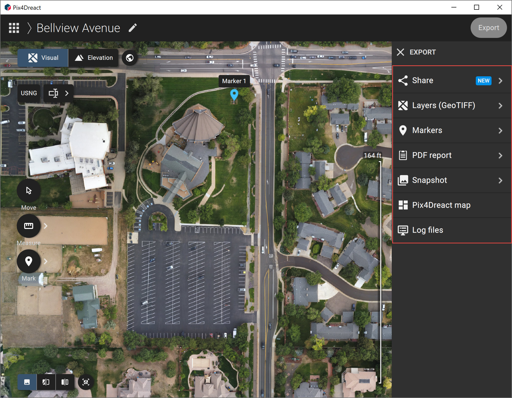
PIX4Dreact can export these outputs which can be used outside the software or shared with external stakeholders:
- Share to PIX4Dcloud: A platform for easy-to-share 2D maps for enhanced collaboration. For more information visit the Share to PIX4Dcloud support documentation page.
- Layers (GeoTIFF): 2D visual or elevation map generated by blending multiple orthophotos. The orthomosaic is color balanced and georeferenced. Export options include the ability to reduce the image size (MB). This includes a reduced image scale for a lower a megabyte image in addition to using overviews (image pyramids). Overviews provide a more responsive viewing experience in third-party image applications, but require extra disk space.
- Markers (GeoJSON, Shapefile (.zip)): Vector files which include the geometry features Point, Line, and Area.
- PDF Report (.pdf): Low-resolution version of the orthomosaic which contains an overview of the map. Optionally, the surface model and markers can be exported and displayed together or individually.
- Snapshot (.jpeg, .png): Image of orthomosaic with or without markers and basemap.
- PIX4Dreact map (.p4r): Map files used for importing into PIX4Dreact on another computer. These files include a .p4r file which contains information about the map, a snapshot of the orthomosaic (.png), the orthomosaic (GeoTIFF), the surface model (GeoTIFF) and the markers (GeoJSON).
- Log files: Text files that show useful information about the processing of the project. They describe the steps and substeps of processing, the actions taken, the warnings and the errors during the processing. Log files are needed when experiencing a problem, and when requested by technical support.