This PIX4Dmapper article explains each section and the action buttons in the GCP/MTP Manager.
Access: On the Menu bar, click Project > GCP/MTP Manager...
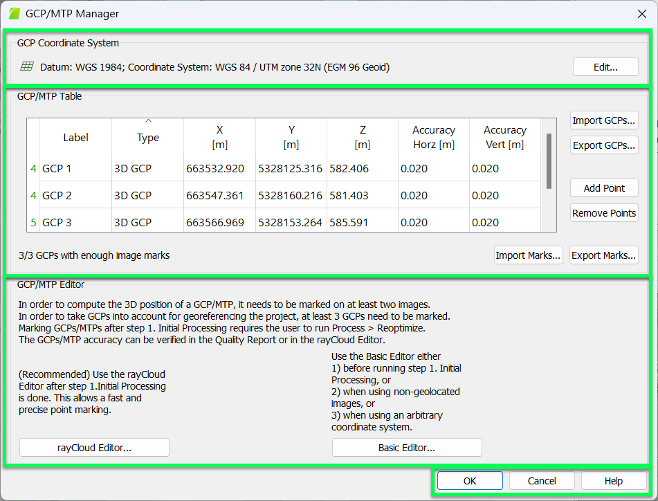
The GCP/MTP Manager pop-up has the following 3 sections:
- GCP Coordinate System: Section to select the coordinate system on which the GCPs/MTPs/Check Points position are based.
- GCP/MTP Table: Section to:
- Import, export, add, and remove GCPs/MTPs/Check Points
- Export GCPs/Check Points coordinates and, optionally for GCPs, the accuracy of the coordinates.
- Import or export a file with the image coordinates of the GCPs/MTPs/Check Points and on which images have been marked, in which position and at which zoom level.
- GCP/MTP Editor: Section to mark the GCPs/MTPs/Check Points on the images. There are two ways of marking available. This includes the rayCloud Editor... and Basic Editor...
And the action buttons:
- OK: Confirms the changes.
- Cancel: Does not save the changes.
- Help: Opens the PIX4Dmapper help.