PIX4Dmapper can process images taken with any camera:
- Lightweight compact cameras.
- DSLR cameras.
- Large format cameras.
- Action cameras.
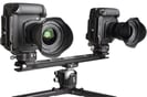
- Camera Rigs.
- Multispectral cameras.
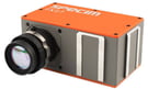
- Hyperspectral cameras.
- Thermal cameras.
- Smart Phones.
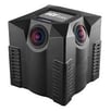
- 360 ° panorama cameras.


Using any lens:
- Perspective (narrow and wide field of view).
- Fisheye (Ultra-wide field of view).
Using any platform:
- UAVs.
- Crewed aircraft.
- Terrestrial vehicles.
- Handheld camera.
Using any spectral specifications:
- RGB cameras.
- NIR, Red Edge cameras for agriculture applications.
- Thermal cameras: Processing thermal images.
- Hyperspectral cameras.
Summary
- Perspective and fisheye lens supported.
- The zoom should be stable.
- Fixed focal length is recommended.

- Stabilization settings should be off.
- Shutter/aperture/ISO should be on automatic.
- If images are blurry or noisy, manually set shutter/aperture/ISO. For more information: Camera settings.
- Set Manual Focus to Infinity.

Camera Body
As a rule of thumb: Heavier cameras (higher pixel resolution) provide better results but require a flying platform for a heavier payload.
Recommended Cameras
Pix4D does not recommend a specific brand or model of camera.
Video cameras
- Videos are not recommended for accurate mapping: The quality of the results will almost always be inferior to the results from still imagery.
- A 4K video may provide reasonable results.
- Full HD video is usually not sufficient to get good results.
- When using a video for processing, it is important to consider the following: How to use Videos for Processing.
Recommended Camera Focal Length
There is no limit in the focal length that can be used with PIX4Dmapper.
Most lens manufacturers give the focal length (F35) that corresponds to 35 mm equivalent. To find the real focal length:
FR = (F35 * SwR) / 34.6 (mm)
where:
F35 = focal length that corresponds to 35 mm equivalent [mm]
FR = real focal length [mm]
SwR = the real sensor width [mm]
For a given height, the wider the field of view (short focal length), the fewer the images to achieve sufficient overlap. This is especially useful if a regular and dense flight plan cannot be set up. The spatial resolution, though, will be low leading to less accurate results.
If the field of view is narrow (long focal length), more images will be required to ensure enough overlap when mapping the same area. The spatial resolution will be higher in this case, leading to more accurate results.
For more information about how to select camera focal length and flight altitude considering the desired spatial resolution (GSD) and the area to map: How to select Camera Focal Length and Flight Altitude considering the desired Ground Sampling Distance and Terrain to map?.
Camera Settings
The shutter speed, aperture, and ISO should be set on automatic. If images are blurry or noisy, it is recommended to manually set these parameters.
There is a tradeoff between the shutter speed, the aperture, and the ISO sensitivity. For processing, the images should be sharp and have the least amount of noise. Such images can be obtained when the scene is well illuminated (scattered clouds should be avoided), and the camera parameters are well adjusted. If the scene is not sufficiently illuminated, images will be noisier and less sharp, thus lowering the accuracy of the results.
- As a rule of thumb, the shutter speed should be fixed, the ISO needs to be set at a low value that does not produce noisy images, and the aperture should be set to automatic to adjust for varying levels of brightness in the scene. If the tradeoff is not correct, overexposed or underexposed images may be obtained.
The shutter speed should be fixed and set to a medium speed (as an indication: between 1/300 second and 1/800 second), but fast enough to not produce blurry images. If more than 5% of the images are subject to a directional blur, it is a good indication that the shutter speed should be slightly increased.
The ISO should be set as low as possible (minimum 100). High ISO settings generally introduce noise into images and drastically reduce the quality of the results.
The aperture minimum and maximum values depend on the lens. High aperture is translated into low numbers, for example, f2.7 (which will capture a lot of light). If both the shutter speed and ISO are adjusted, it is better to leave the aperture (f) on automatic. - The electronic and mechanical stabilization should be disabled as it interferes with PIX4Dmapper's algorithms.
- The recommended focus mode is Manual Focus on Infinity. This mode of focusing should always give focused images for aerial projects. For terrestrial projects, this mode will probably lead to out of focus results, if a long focal length is used.
Problems with images due to wrong camera parameters or inadequate equipment that interfere with the processing: