Create a new dataset to start processing imagery and create maps and digital twins of the reality or upload outputs to PIX4Dcloud.
Access: To upload images under the credit balance system, navigate to step 2 of the wizard project.
Licenses: This article is valid for all PIX4Dcloud licenses.
Roles:
- Only Owners can buy credits on behalf of the Organization.
- Only Owners, Managers, and Editors can create and process datasets in PIX4Dcloud.
| 1.Dataset creation > | 2. Image selection > | 3.Output coordinate system > | 4.Processing options > | 5. GCPs automation |
To select the images:
- Drag and drop the images or search for the folder where they are stored. For more information: Inputs.
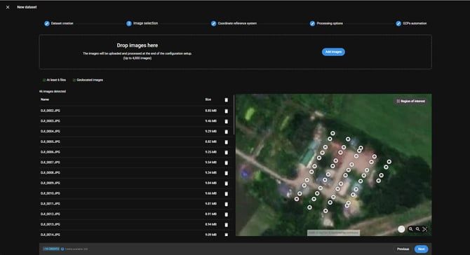
- (Optional) To add more images, drag and drop additional images or click Select images and browse to the folder where the additional images are stored.
- (Optional) Delete some images if necessary by clicking on the icon
 .
. - (Optional) Draw a region of interest.
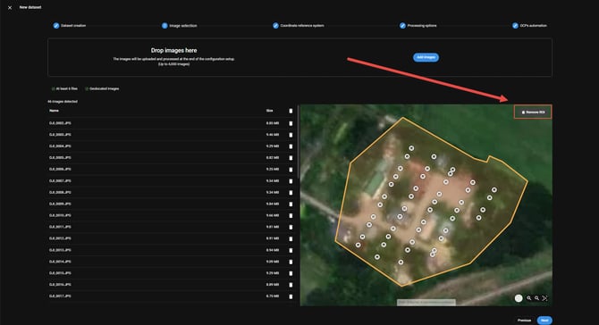
- Select Next and follow the instructions for step 3. Processing options.
Warning: Images without geolocalization are not displayed on the map. Images without geolocation are automatically deleted by PIX4Dcloud, and the Next button will appear greyout until these images are manually deleted since it is not possible to process the project with them.
Note: If there are not enough credit balances available for processing, a warning is showing in the project wizard. To buy more credits, access the following link, https://account.pix4d.com/credits.
Warning: If projects are uploaded to be processed without having enough credits, the following status will be displayed in the PIX4Dcloud interface:
- Individual projects, it shows Waiting for credits status in the drive.
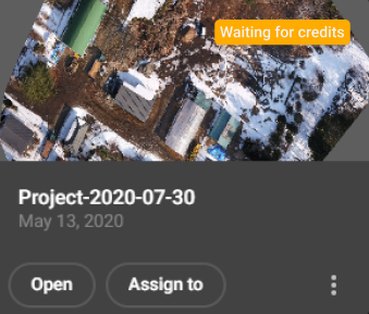
- For sites,the projects in Credits status are displayed in the timeline.
