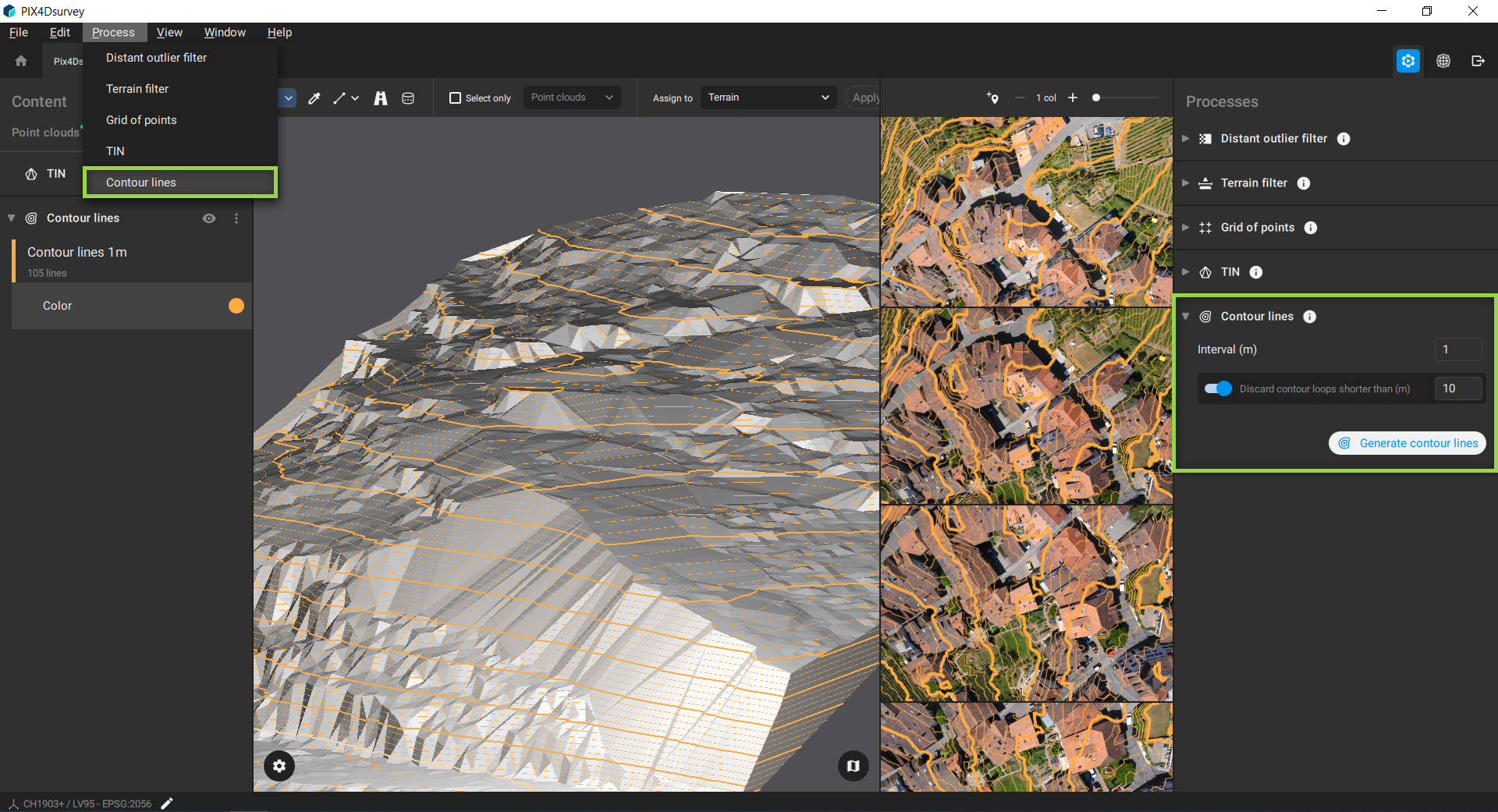
The Contour lines feature connects points of the same height with a polyline. The height values are extracted from the TIN (Triangular Irregular Network). Major and minor contour lines which are projected also onto the images are generated with this feature.
アクセス:
- 画面右上の プロセス
 あるいは、
あるいは、 - On the Menu bar, click Process > Contour lines.
Note: To generate contour lines the TIN needs to be generated in the project.
以下の設定を変更できます:
- Interval [units]: It defines the contour line elevation interval. It can be in meters or in imperial according to the coordinate system used:
- 1 m - 既定値。
- 3フィート(米国) - デフォルト。
Tip: The minimum interval value supported is 0.1. Values below this threshold are not valid and will not be accepted.
- Discard contour loops shorter than [units]: It detects and discards contour lines with shorter length. It can be in meters or in imperial according to the coordinate system used:
- 10 m - 既定値。
- 30フィート(米国) - デフォルト。
Starting with PIX4Dsurvey 1.82.0, contour lines in the 3D view display labels indicating their elevation.

Example: Contour lines generated from terrain points of the PIX4Dsurvey example dataset.