Skip to content
English
  • 検索欄が空のため、提案はありません。

タイポイント(GCP、CP)のインポート形式 -PIX4Dmatic

Tie points, including Ground Control Points (GCPs) and Checkpoints, can be imported using a .csv or .txt file. Each line contains either four or six columns, separated by commas (,). The supported tie point formats are detailed in the table below:


Note: The order of coordinates in the input file must match the order of axes in the coordinate system definition chosen in the import dialog.
For example, if the coordinate system definition specifies the first axis is X and the second is Y, the GCP input file must follow the same order.
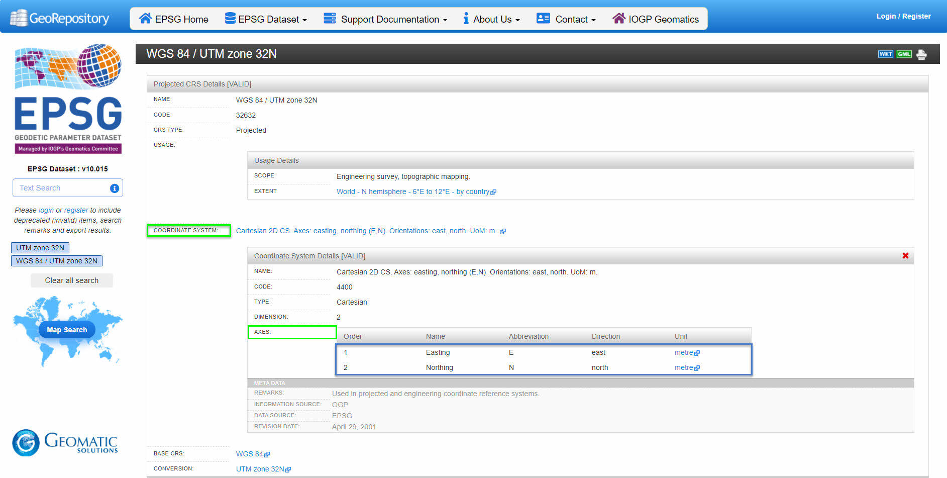
GCPs in geographic coordinates

label, coordinate1* [decimal degrees], coordinate2* [decimal degrees], z [meter]

GCP0,46.23456,6.56114,299.931
GCP1,46.23234,6.56234,299.823

緯度の値は -90° から 90° の範囲です。
経度の値は -180° から 180° の範囲です。

GCPs in geographic coordinates with accuracy values

label, coordinate1* [decimal degrees], coordinate2* [decimal degrees], z [meter], Accuracy Horz [meter], Accuracy Vert [meter]

GCP0,46.23456,6.56114,299.931,0.02,0.02
GCP1,46.23234,6.56234,299.823,0.02,0.02

緯度の値は -90° から 90° の範囲です。
経度の値は -180° から 180° の範囲です。

GCPs in projected coordinates

label, coordinate1* [units], coordinate2* [units], z [units]

GCP0,2532795.105,1152094.639,395.883
GCP1,2532728.805,1152079.825,396.619
GCPs in projected coordinates with accuracy values

label, coordinate1* [units], coordinate2* [units], z [units], Accuracy Horz [units], Accuracy Vert [units]

GCP0,2532795.105,1152094.639,395.883,0.02,0.02
GCP1,2532728.805,1152079.825,396.619,0.02,0.02

座標系の定義における軸の順序を確認する方法

座標系の定義における軸の順序を確認するには:

  • EPSG測地パラメータ登録簿のウェブサイトを開いてください。
  • Write the name or the EPSG code in the EPSG Dataset - Text search.
  • Click GO and select the correct name in the results..
  • 座標系」セクションを展開し、「」サブセクションの順序を確認してください。

After checking the order of the axes in the coordinate system definition, modify the input file to follow the same order of coordinates.

例:WGS 84 / UTM ゾーン 32N(EPSG コード 32632)の場合、座標系定義における軸の順序は、最初に東経、次に北緯となります。GCPs ファイルは、以下の形式で記述する必要があります:
ラベル、東経 [メートル]、北緯 [メートル]、z [メートル]

EPSG Geodetic Parameter Registry