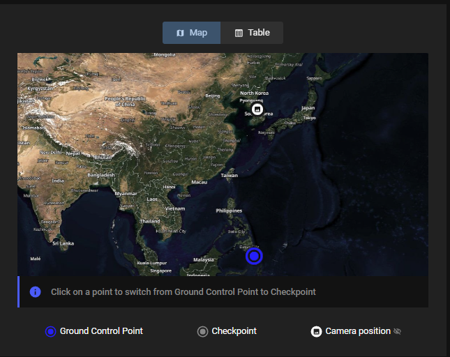
Misalignment between images and GCPs in PIX4Dcloud Pro dataset creation wizard
This article explains the possible reasons why GCPs and images are not aligned in step 5. GCPs automation of the PIX4Dcloud dataset wizard.
Licenses: This article is only valid for PIX4Dcloud Pro licenses.
Roles: Only Owners, Managers, and Editors can process a dataset with GCPs.

Expected visualization. |
 Misaligment between dataset and GCPs. |
Warning: If the GCPs are not aligned, the AutoGCP functionality will not be able to find any points and the GCPs will not be considered for project processing.
- Check if the GCPs are given in the same coordinate system as the output one.
Issue description: In step 3 of the project wizard the user can manually define the output reference coordinate system, or can decide to use the default coordinate system detected from the images geotags.
When using GCPs, they have to be given in the output coordinate system. If this is not the case, the coordinates of the GCPs have to be converted before importing them in PIx4Dcloud.
Solution: Make sure that the GCPs coordinate system is the same as the output coordinate system defined in step 3. - Check the order of Easting / Northing coordinates of the GCPs.
Issue description: If the GCP's coordinate system is correct and the same as the output coordinate system, then it is possible that the order of the x and y coordinates of the GCPs has been reversed. This can be verified by clicking on Table.
Solution: If the coordinates are inverted then this can be fixed by clicking on Easting or Northing to correct it. - Check if the GCPs coordinates are correct.
Issue description: It is possible that GCP coordinates have been manually entered incorrectly into csv or have been measured incorrectly.
Solution: In these cases we recommend checking with the surveyor who performed the measurements if the information in the CSV is correct.
