Issue
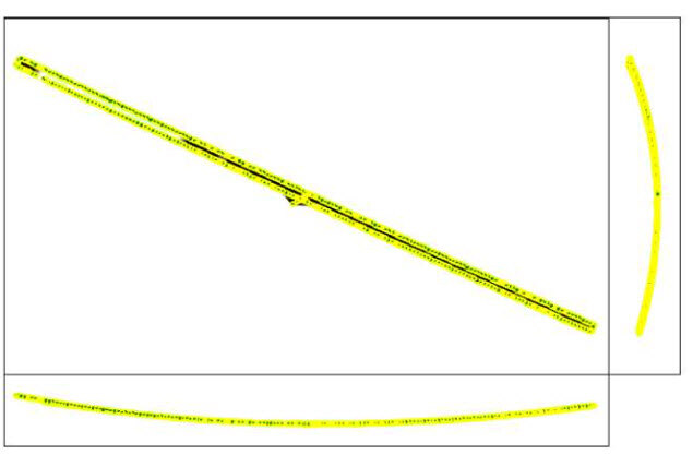
The model shows a curvature that is not accurate to the actual terrain. Warped or curved models typically occur because of the quality of the camera that is used for the dataset acquisition or the type or terrain. Long corridor projects are especially prone to this.
Indicators
Causes
- Corridor projects are, in general, more prone to inaccuracies, especially if there is only one line of flight and no image geolocation.
- Cameras with a rolling shutter can have a negative impact on the reconstruction depending on the flight conditions and the area that is mapped.
Solutions
Possible solutions to the previously listed causes are proposed below.
For cause 1, corridor projects
- Dataset(s) should consist of at least 2 parallel flight lines with high overlap: Step 1. Before Starting a Project> 1. Designing the Image Acquisition Plan> a. Selecting the Image Acquisition Plan Type.
- Using highly accurate image geolocation (RTK or PPK drone) is recommended.
- It is highly recommended to have Ground Control Points (GCPs) well distributed in the model: Number and distribution of ground control points (GCPs) in corridor mapping.
For cause 2, rolling shutter
To mitigate the effect of the rolling shutter, we suggest applying the rolling shutter correction algorithm, especially for flights with a regular pattern (lines): How to correct for the Rolling Shutter Effect.
- Review how the camera and the flight parameters influence the amount of linear rolling shutter distortion present in images with Pix4D's vertical pixel displacement calculator.
- Enable the linear shutter optimization in the Menu Project > Image Properties Editor....
- Capture the project area again while flying slower and/or at a higher altitude to reduce the amount of linear rolling shutter distortions that are present in your images.
- Use the All prior camera optimization option together with the linear rolling shutter algorithm.