Important: PIX4Dmatic and PIX4Dcloud support the use of site calibration files in WKT (Well-Known Text) format; however, they do not include functionality for creating these files directly within the applications. To obtain a WKT site calibration file, contact Pix4D Technical Support. For more information, How to obtain a Site Localization file for PIX4Dmatic and PIX4Dcloud.
Once the project has been processed, it is possible to view it in PIX4Dcloud. There are some differences in the user interface with respect to a standard project:
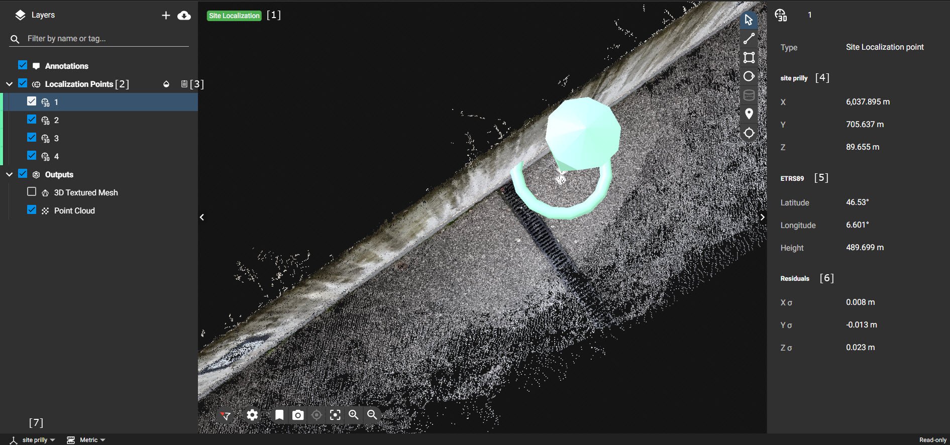
- Site Localization tag [1]: The tag added on the 2D/3D view indicates that the project is processed with a site localization file defining the custom coordinate system.
- Localization Points layer [2]: It contains all the points that were used to compute the Site Localization.
- Download WTK string file [3]: Allows to download a file that defines the custom coordinate system. The file can also be imported into PIX4Dmatic for processing projects.
- Site localization point: By clicking on each point, the following information is displayed:
- Local coordinates [4]: Refers to point measure in the custom coordinate system defined by the user.
- Global coordinate [5]: Coordinates of the point of the selected global coordinate system in PIX4Dcatch + rover.
- Residuals [6]: Residuals of the transformation from a global to a custom coordinate system at that point.
- Coordinate system switcher [7]: It shows the name of the custom coordinate system.