IN THIS ARTICLE
Open an IFC file in Revit
Define Project Base Point and Survey Point
Export an IFC file from Revit
Import and visualize an IFC file on PIX4Dcloud
Licenses: This article is only valid for PIX4Dcloud Pro licenses (formerly PIX4Dcloud Advanced).
Roles: Only Owners, Managers, and Editors can import and visualize IFC files in a dataset in PIX4Dcloud.
Open an IFC file in Revit
If the IFC file has already been generated, open it by selecting the appropriate project template from the Revit home view.
To import an IFC file into an existing Revit project:
-
On the menu bar, click Insert.
-
In the dialog window, navigate to the IFC file.
-
Click Open.
After opening or importing the IFC file, the Project Base Point and Survey Point must be defined to georeference the model.
Define Project Base Point and Survey Point
Correct georeferencing of an IFC file in Revit requires defining both the Project Base Point and the Survey Point.
Refer to the following articles for detailed instructions:
For best practices on using these reference points together, see Best Practices: Project Base Point and Survey Point.
Once both points are correctly defined, the IFC file is ready to be exported.
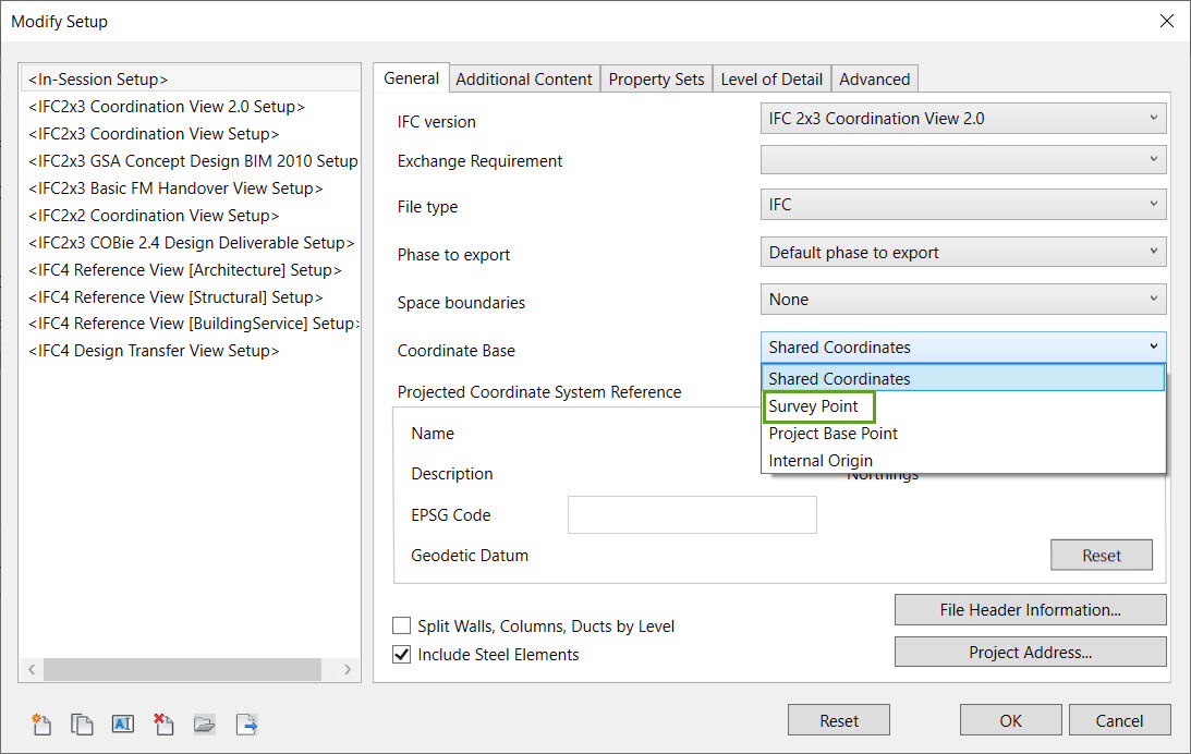
Export an IFC file from Revit
To export the IFC file with the correct coordinate system:
-
On the menu bar, click File > Export > IFC.
-
In the Export IFC dialog, click Modify setup….
-
In the General tab, select Survey Point as the Coordinate Base.
-
Click OK to confirm and export the file.
Import and visualize the georeference IFC file on PIX4Dcloud
The exported IFC file can now be imported into a PIX4Dcloud project and visualized in the 3D view, aligned with the point cloud or 3D mesh.
Warning: If an IFC file was previously imported and appears misaligned, it is recommended to replace it with the correctly georeferenced IFC file.
Third-party information disclaimer:
PIX4D provides instructions for third-party platforms and products solely as a helpful guide to unblock your integration. Those companies are independent of PIX4D. We do not maintain, control, or guarantee the performance, accuracy or reliability of these products.
PIX4D may provide third-party links or contact information to help you find additional information about this topic. This contact information may change without notice. PIX4D does not guarantee the accuracy of third-party documentation or contact details.