PIX4Dmatic and PIX4Dmapper comparison
PIX4Dmatic, similarly to PIX4Dmapper, is intended for accurate and photogrammetric processing for aerial and terrestrial projects. This article describes the similarities and differences between the two products in detail.
IN THIS ARTICLE
General differences between PIX4Dmatic and PIX4Dmapper
Similarities and differences between calibration processing options
Test benchmark PIX4Dmatic vs PIX4Dmapper
Calibration and densification steps
DSM and Orthomosaic steps
Total processing time
General differences between PIX4Dmatic and PIX4Dmapper
PIX4Dmatic is our next-generation photogrammetry software, ideal for datasets of any size captured with standard RGB cameras. Furthermore, PIX4Dmatic fully supports the terrestrial PIX4Dcatch workflow with LiDAR and RGB image processing, as well as a fusion of both point clouds.
Similarities and differences between calibration processing options
- It is the default calibration method in PIX4Dmapper.
- It is the default calibration pipeline in PIX4Dmatic.
- It is not available in PIX4Dmapper.
Test benchmark PIX4Dmatic vs PIX4Dmapper
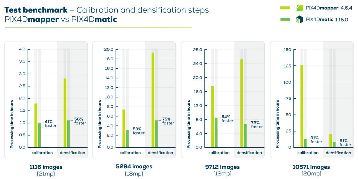
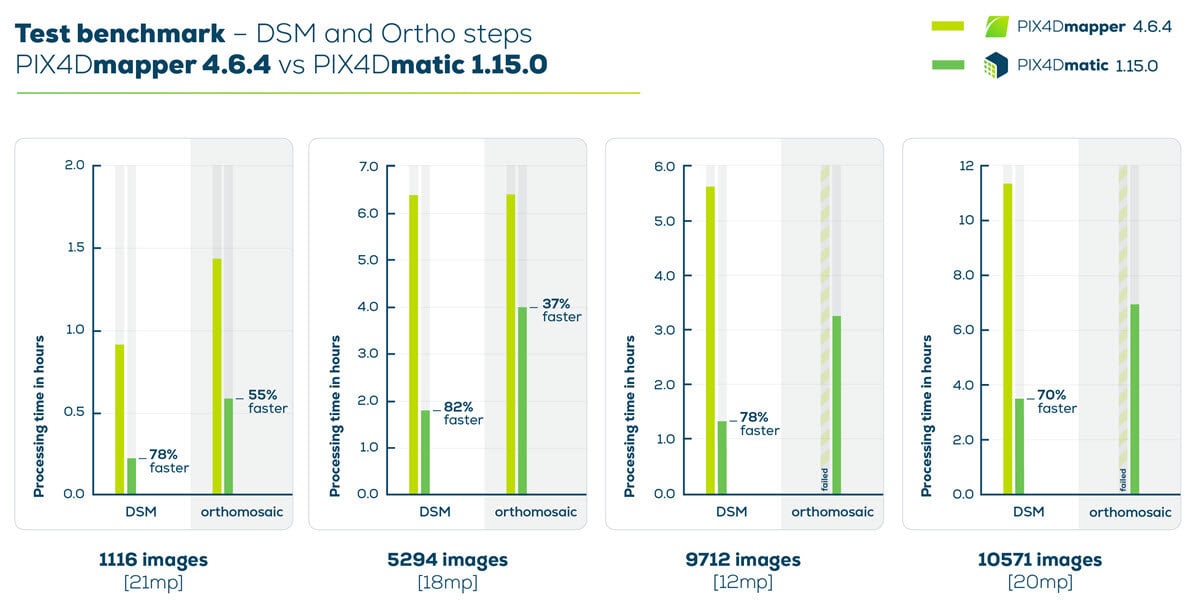
In the following sections, we are comparing the PIX4Dmatic Large scale and corridor calibration template with the PIX4Dmapper 3D Maps template.
Calibration and densification steps:
The calibrate step and densify steps are faster in PIX4Dmatic compared to PIX4Dmapper.

DSM and Orthomosaic steps:
PIX4Dmatic generated a DSM 82% faster than PIX4Dmapper, and the orthomosaic generation was successful even for large projects.

Total processing time:
PIX4Dmatic processed a dataset with 5294 images almost 70% faster than PIX4Dmapper.

