This article explains the key concepts of project coordinate systems and the transformation of import files in the context of geospatial data processing. It covers topics such as defining the coordinate reference system (CRS) of a project based on metadata or existing files, changing the project's CRS, and transforming imported files to ensure proper alignment. The article provides step-by-step instructions for managing coordinate systems and offers tips for selecting and creating CRS files.
IN THIS ARTICLE
Project coordinate system
The coordinate reference system (CRS) of the project is automatically defined based on the coordinate system of:
- PIX4Dmapper or PIX4Dmatic project file.
- Coordinate system written in the metadata of the imported point cloud.
To change the project's coordinate system [1] after it is created:
- Click the
 icon [2] in the bottom bar.
 - In the Define project coordinate reference system [3] dialog set the:
- Horizontal coordinate reference system,
- Vertical coordinate reference system,
- (Optional) Geoid,
- (Optional) Geoid height.
- Click Apply [4].
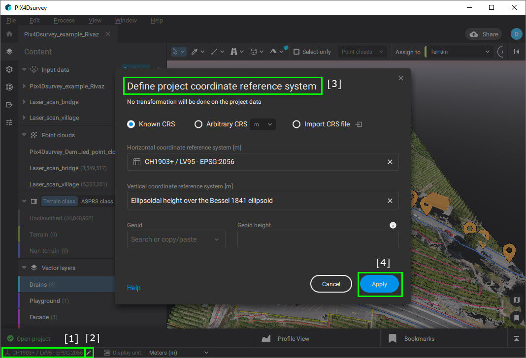
When changing the coordinate system, the originally imported data is not transformed and only the coordinate system definition changes.
Transformation of import files
When the coordinate system of the project is already defined, the new imported files can be transformed at import. This way you can ensure that they overlay correctly with existing data.
The following file formats can be transformed:
- Point cloud in .las and .laz file formats.
- Vector files (.dxf, .json, .shp files) with 2D and 3D objects.
- A point cloud in geographic coordinate system WGS84 - EPSG:4326.
- Project in projected coordinate system WGS 84 / UTM zone 32N - EPSG:32632.