Here is a description of the available processing templates:
Processing Options Template
Characteristics
Outputs generated
Standard
3D Maps
Generates a 3D map (point cloud, 3D textured mesh), as well as a DSM and an orthomosaic.
Image acquisition: nadir or oblique flight.
Typical input: aerial images acquired using a grid flight plan with high overlap.
Outputs quality/reliability: high.
Processing speed: slow.
Application examples: quarries, cadaster, etc.
Image acquisition: nadir or oblique flight.
Typical input: aerial images acquired using a grid flight plan with high overlap.
Outputs quality/reliability: high.
Processing speed: slow.
Application examples: quarries, cadaster, etc.
Orthomosaic
DSM
3D Mesh
Point Cloud
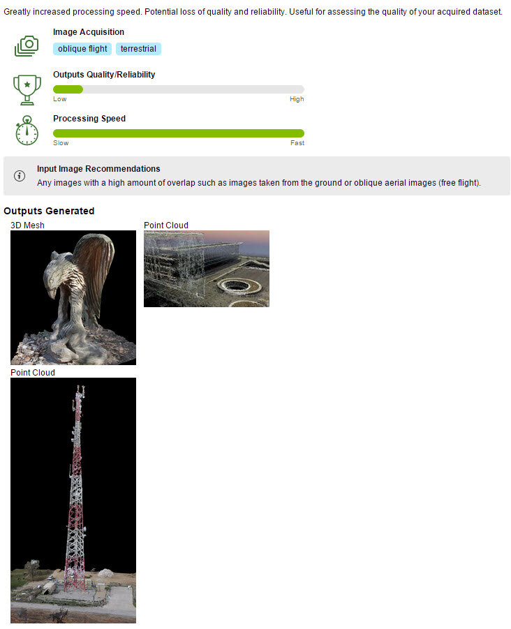
3D Models
Generates a 3D model (point cloud, 3D textured mesh).
Image acquisition: oblique flight or terrestrial.
Typical input: any images with high overlap.
Outputs quality/reliability: high.
Processing speed: slow.
Application examples: 3D models of buildings, objects, ground imagery, indoor imagery, inspection, etc.
Image acquisition: oblique flight or terrestrial.
Typical input: any images with high overlap.
Outputs quality/reliability: high.
Processing speed: slow.
Application examples: 3D models of buildings, objects, ground imagery, indoor imagery, inspection, etc.
3D Mesh
Point Cloud
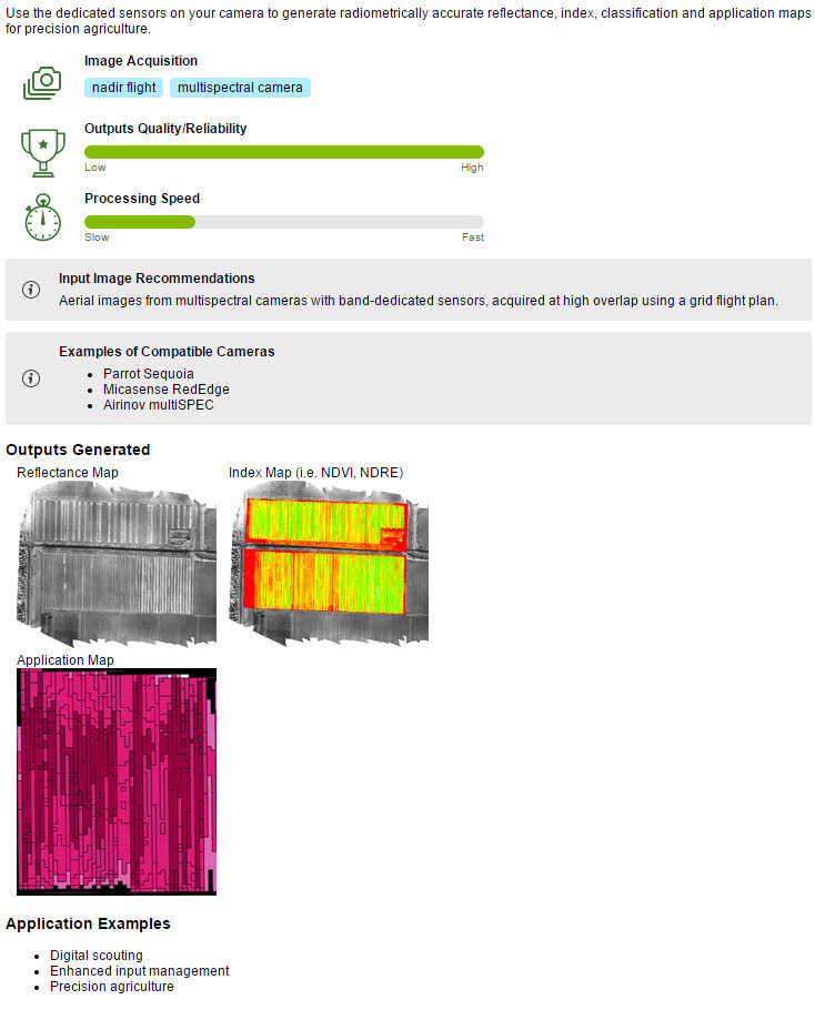
Ag Multispectral
Generates reflectance, index (such as NDVI), classification and application maps.
Image acquisition: nadir flight with a multispectral camera.
Typical input: images taken with a multispectral camera (Sequoia, Micasense RedEdge, Multispec 4C, etc).
Outputs quality/reliability: high.
Processing speed: slow.
Application examples: precision agriculture.
Image acquisition: nadir flight with a multispectral camera.
Typical input: images taken with a multispectral camera (Sequoia, Micasense RedEdge, Multispec 4C, etc).
Outputs quality/reliability: high.
Processing speed: slow.
Application examples: precision agriculture.
Reflectance Map
Index Map
Application Map
Rapid
3D Maps - Rapid/Low Res
Faster processing of the
3D Maps template for assessing the quality of the acquired dataset.
Outputs quality/reliability: low.
Processing speed: fast.
Outputs quality/reliability: low.
Processing speed: fast.
Orthomosaic
DSM
3D Mesh
Point Cloud
3D Models - Rapid/Low Res
Faster processing of the
3D Models template for assessing the quality of the acquired dataset.
Output quality/reliability: low.
Processing speed: fast.
Output quality/reliability: low.
Processing speed: fast.
3D Mesh
Point Cloud
Ag Modified Camera - Rapid/Low Res
Faster processing of the
Ag Modified Camera template for assessing the quality of the acquired dataset.
Output quality/reliability: low.
Processing speed: fast.
Output quality/reliability: low.
Processing speed: fast.
Reflectance Map
Index Map
Application Map
Ag RGB - Rapid/Low Res
Faster processing of the
Ag RGB template for assessing the quality of the acquired dataset.
Output quality/reliability: low.
Processing speed: fast.
Output quality/reliability: low.
Processing speed: fast.
Orthomosaic
Advanced
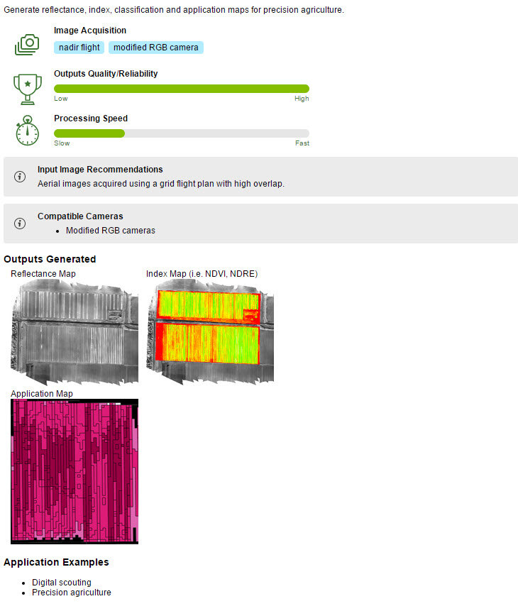
Ag Modified Camera
Generates reflectance, index (such as NDVI), classification and application maps.
Image acquisition: nadir flight with a modified RGB camera.
Typical input: images taken with a modified RGB camera.
Outputs quality/reliability: high.
Processing speed: slow.
Application examples: precision agriculture.
Image acquisition: nadir flight with a modified RGB camera.
Typical input: images taken with a modified RGB camera.
Outputs quality/reliability: high.
Processing speed: slow.
Application examples: precision agriculture.
Reflectance Map
Index Map
Application Map
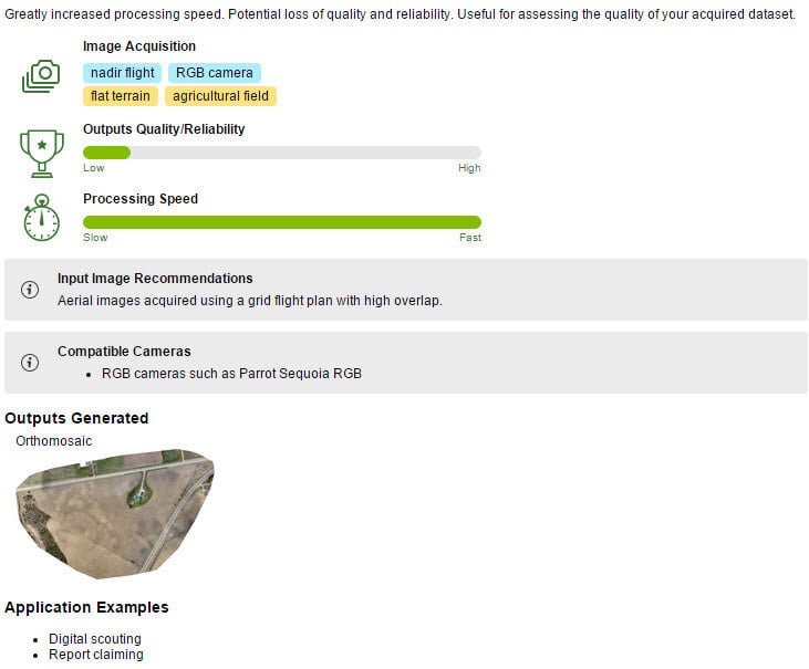
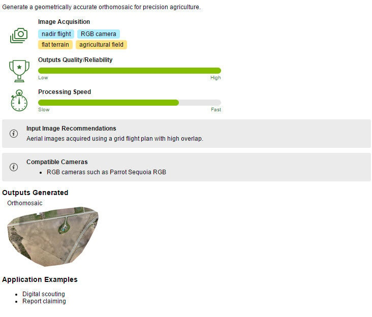
Ag RGB
Generates an orthomosaic for precision agriculture.
Image acquisition: nadir flight over flat terrain with an RGB camera.
Typical input: images taken with an RGB camera for agriculture (Sequoia RGB).
Outputs quality/reliability: high.
Processing speed: average.
Application examples: digital scouting, report claiming for precision agriculture.
Image acquisition: nadir flight over flat terrain with an RGB camera.
Typical input: images taken with an RGB camera for agriculture (Sequoia RGB).
Outputs quality/reliability: high.
Processing speed: average.
Application examples: digital scouting, report claiming for precision agriculture.
Orthomosaic
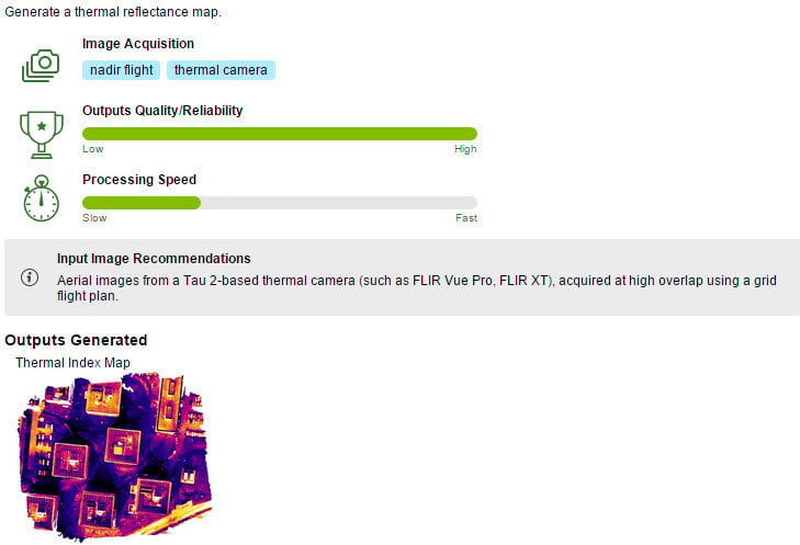
Thermal Camera
Generates a thermal reflectance map.
Image acquisition: nadir flight with a thermal camera.
Typical input: images taken with a thermal camera (such as Tau 2 based cameras: FLIR Vue Pro, FLIR XT).
Output quality/reliability: high.
Processing speed: slow.
Image acquisition: nadir flight with a thermal camera.
Typical input: images taken with a thermal camera (such as Tau 2 based cameras: FLIR Vue Pro, FLIR XT).
Output quality/reliability: high.
Processing speed: slow.
Thermal Index Map
ThermoMAP Camera
Generates a thermal reflectance map.
Image acquisition: nadir flight with a thermoMAP camera.
Typical input: images taken with a thermoMAP camera.
Output quality/reliability: high.
Processing speed: slow.
Image acquisition: nadir flight with a thermoMAP camera.
Typical input: images taken with a thermoMAP camera.
Output quality/reliability: high.
Processing speed: slow.
Thermal Index Map
Note: In the window
Processing Options Template, a section titled
Personal appears above the
Standard section when a new personal template has been created by the user.