IN THIS ARTICLE
Single flight following the terrain elevation variation (recommended)
Multiple flights at different constant altitudes
Single flight at a constant altitude regardless of the terrain changes in altitude (not recommended)
Single flight following the terrain elevation variation (recommended)
It is the recommended method since the GSD will be constant for the project since the height difference between the UAV and the terrain is maintained. Be aware that only some of the flying applications can achieve such flights.
Multiple flights at different constant altitudes
Perform multiple flights at different altitudes with the flight lines perpendicular to the slope. It is important that there is overlap between the flights. Additionally, the GSD in the overlapping areas between the missions should be similar by a factor of two.
The GSD will be approximately constant for the project since the height difference between the UAV and the terrain is maintained.

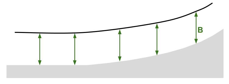
Single flight at a constant altitude regardless of the terrain changes in altitude (not recommended)
If the height difference between the UAV and the terrain is not maintained (keeping constant flight altitude):
- It will affect the GSD: The GSD will not be the same over the whole project because of the variations in elevation of the terrain. In Figure 3, the GSD is more detailed in area B.
- It will affect the overlap: The overlap will be lower in area B.
