This article describes which are the main parameters of the Index Calculator regarding Color Maps and Prescription in PIX4Dmapper.
IN THIS ARTICLE
Access
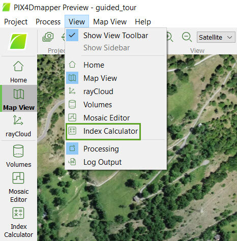
Access: On the Menu bar, click
View Index Calculator (available once step
3. DSM, Orhtomosaic and Index has been completed). The
Index Calculator sidebar is displayed on the right of the main window. For information about the sidebar's display possibilities,
Displaying bars.
Color maps and Prescription
On the left part of section 4. Color Maps and Prescription, there is an arrow that allows show/hide the section by clicking on it:
-
 By default, section 4. Color Maps and Prescription is expanded and visible.
 -
 Section 4. Color Maps and Prescription is collapsed and hidden.
By expanding the section, the following information is displayed:
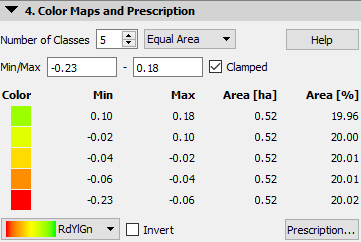
- Number of Classes: Number of classes to classify the model. The default value is 5, the minimum value is 2, and the maximum is 32.
- Method of classification: It is possible to classify the area (classify the pixels in intervals based on their index value and represent each interval using one class and, therefore, one color) considering:
- Equal Spacing: Selected by default, all classes have the same range.
- Equal Area: All classes represent the same area in the model.
- Jenks: Uses the Jenks natural breaks optimization method. For more information, Jenks natural breaks optimization.
 Equal SpacingEqual AreaJenks
- Use Min/Max:
Enter the minimum and maximum index values to ignore the values outside this range.
- Clamped: Displays the pixels with an index value outside the selected range (Min/Max) with the color of the minimum or maximum selected index values. It is selected by default. If not selected, the pixels with an index value outside the selected range (Min/Max), will be displayed with transparency.
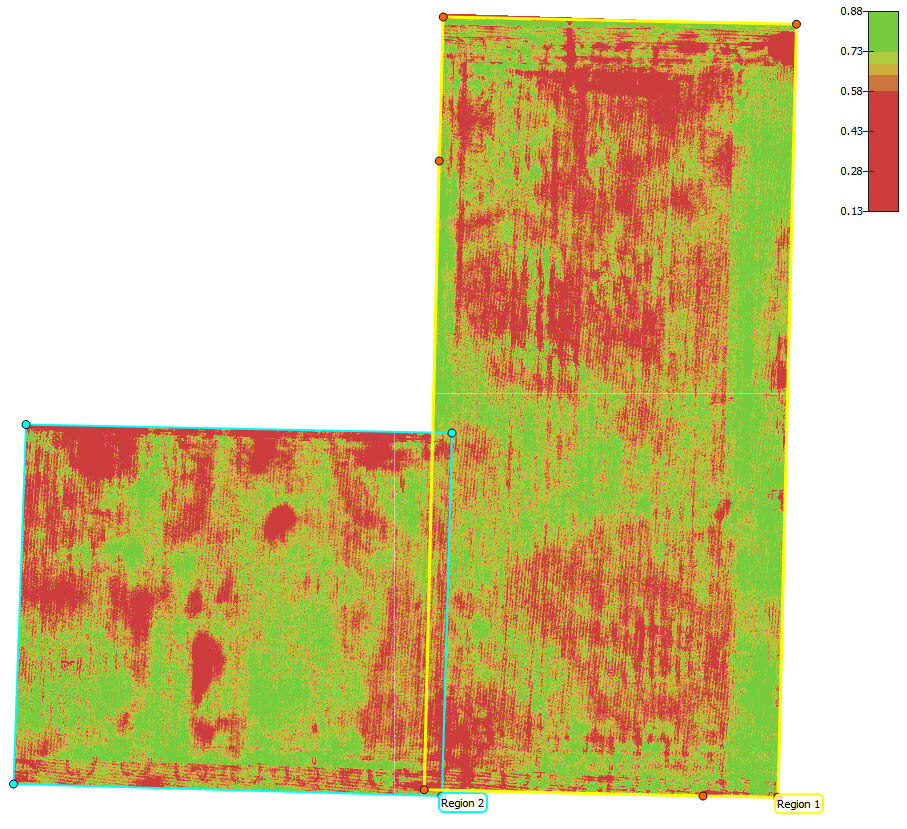
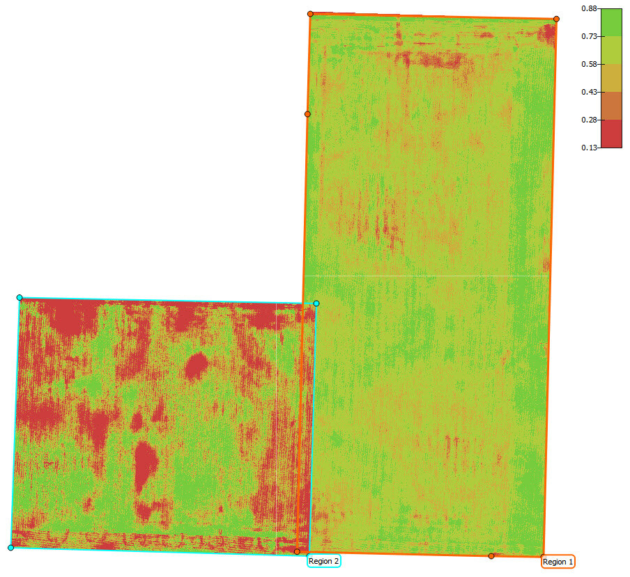
- Classes description: It displays the properties of the classes.
- Color: Color used in the Index View to represent the class.
- Min / Max: Index value range used for each class.
- Area [units]: Surface covered by the class.
- Area [%]: Percentage of the total area occupied by the region.
- Colors Distribution: Contains the palettes used for coloring the classes.
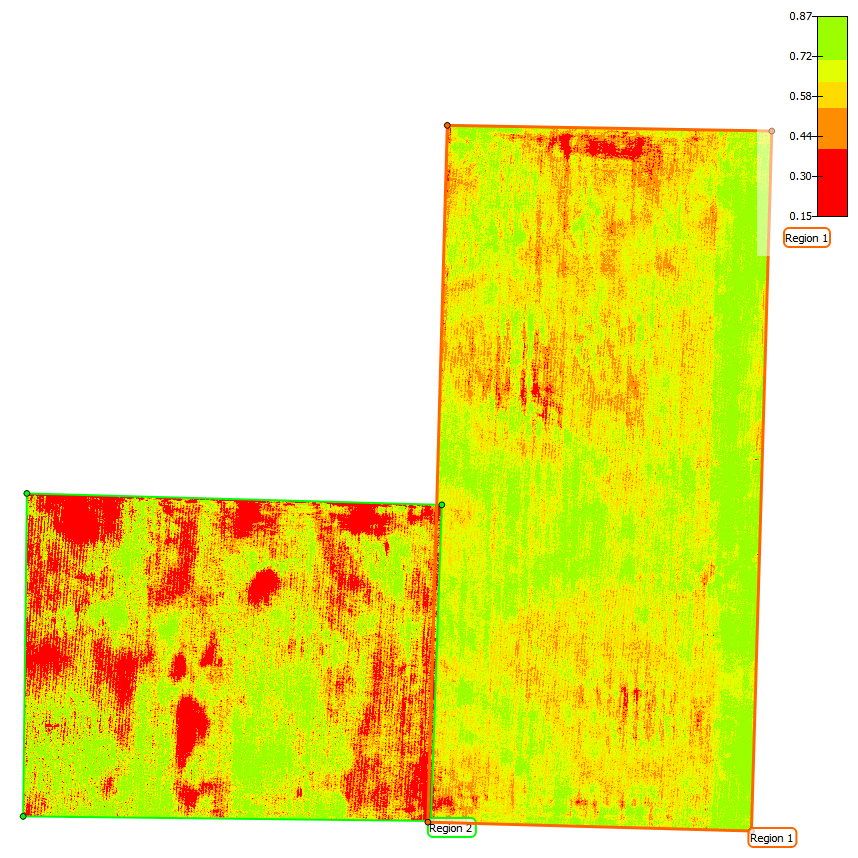
- RdYlGn: Low values are red, medium values are yellow and high values are green, used for agriculture.
- Thermal: Low values are blue, and high values are red, used for temperature measurements.
- Spectral: Uses all the colors of the visual spectrum, used when it is needed to distinguish many different values.
- Grays: Uses a grayscale.
- Blues: Uses a blue scale.
- Reds: Uses a red scale.
- Invert: Unselected by default, it allows to invert the selected colors' distribution.
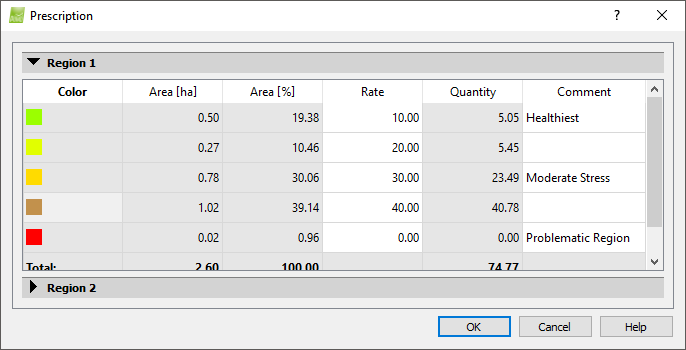
- Prescription...: It displays some classes' parameters and allows to set the application rate and add comments:
- Color: Color used in the Index View to represent the class.
- Area [units]: Surface covered by the class.
- Area [%]: Percentage of the total area occupied by the region.
- Rate: It allows to enter the application rate for each class. This rate value should be filled after the on-site scouting is done. The rate units depend on the tractor software. For chemicals and fertilizer, it could be kg/hectare, grams/hectare, liter/hectare etc. For seeds, it could be seed/hectares.
- Quantity: Area[units] x Rate.
- Comment: It allows to add comments for each class. These descriptions could be notes from the on-site scouting.
- Help: Opens the PIX4Dmapper help.