Index > Interface > Menu Process | Previous | Next |
This article explains the steps to generate a digital terrain model (DTM).
Select Generate DTM.
This process takes as input the merged Raster DSM (Digital Surface Model), computes a classification mask, and generates the Raster DTM (Digital Terrain Model).
![]() |
![]() |
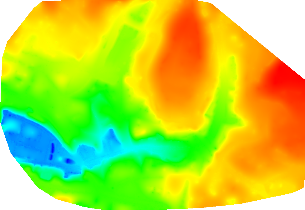
DTM of the center of the city of Lausanne | 
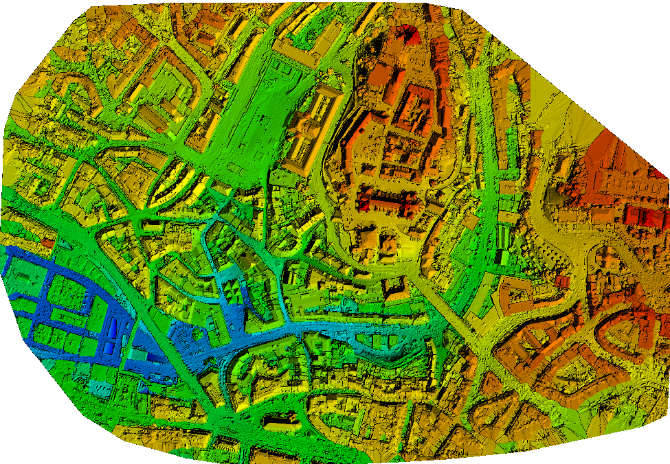
DSM of the center of the city of Lausanne |
Index > Interface > Menu Process | Previous | Next |
I am working to create a highly accurate canopy height model for determining plant height for plant breeding application. I am having a hard time deciding which processing option settings would be most conducive to producing the most accurate DTM possible. Computing power and time are not a problem. I have generated DTM and have gotten mixed results. Occasionally the planted areas will influence the model causing an increase in terrain height collocated with planted areas. What would be one way to get a really accurate terrain model? Is it possible to select data in pix4d above a certain height rather then going through the drudgery of selecting each open area of the field and assigning it as ground and disabling all other areas?
Hi Eric,
It is always challenging when you are calculating the DTM for the area which is covered by the dense vegetation because very few portions of the land are visible to estimate the DTM. However, the best option I would recommend is editing the point cloud. There might be another approach such as mapping the land before vegetation(which is not suitable for this project) and using that DTM model to subtract the DSM model to get the plant height. The only setting recommendation to improve the DTM other than editing the point cloud is enabling the point cloud classification, which you have already used.
For now, Pix4Dmapper doesn't provide the feature that allows you to edit the point cloud based on the altitude. However, I would recommend you to use GIS software such as QGIS, ArcGIS and so on which might be helpful for you for this procedure.
Hi
We want to calculate volume of bench of a open pit mine / quarry
Which has some trees and some vegetation
How does this affect to volume measurement and also which would be best method to do volume measurement in pix4d cloud
Does DTM generated by pix4d can help or we will need to post process output data
Hi Vijay,
As mentioned above by Kapil, it might worth to clean your point cloud with the point cloud editor.
You can also smooth the DTM using surfaces.
During DTM generation, the disabled points are not definitively removed but rather smoothed which can lead sometimes to certain inconsistencies. Besides as the classification is automatic it might need some manual correction.
That's why sometimes we would recommend to generate the DTM in the same way you do so for the DSM, but assigning all point from all classes, except "Ground" and "Road Surface", to the class "Disable". This usually leads to better results.
If you want to preserve some features, you can keep them by assigning them to the class "Ground". Make sure that all the points from features you want to preserve are assign to the correct class.
Then, when you are happy with your classification, you can launch step 3:
Make sure that Raster DTM is unchecked:

One more thing, if you DTM has some holes you can fill them using the "New Surface" tool:
Make sure that you have check the box "Use for DSM and Triangle Mesh":

Hope this will you to improve the quality for your DTM.
Best