Error
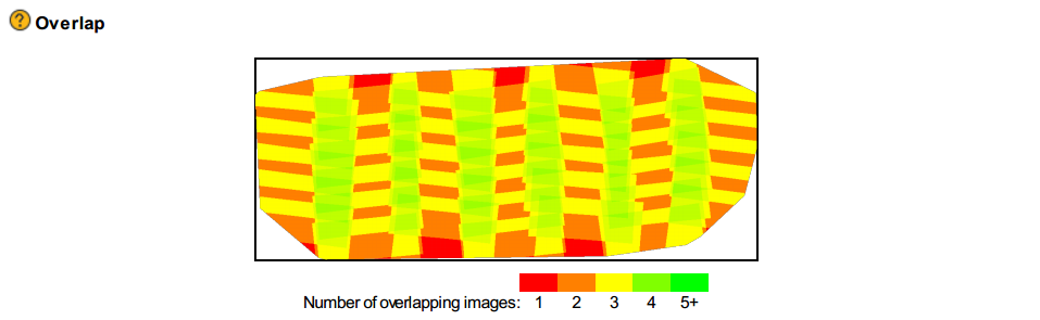
- Green, orange and yellow patches in the Overlap map in the Quality Report.
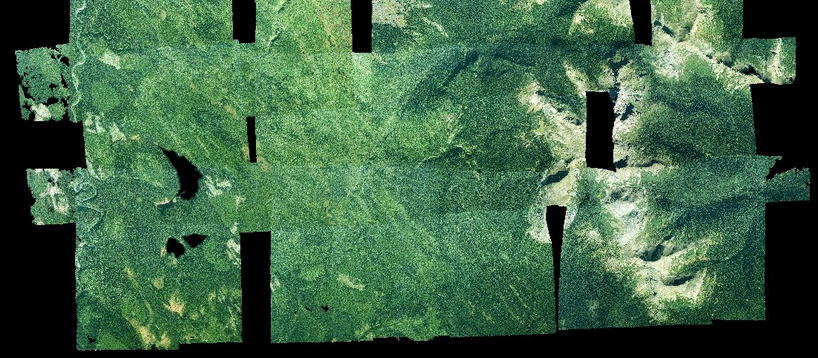
- Black holes (black rectangles or sharp triangles) in the model where no data is generated.
Description
- Green, orange and yellow patches in the Overlap map in the Quality Report.
- Lower accuracy in the position of the 3D points.
- Black holes (black rectangles or sharp triangles) in the point clouds.
- Rectangles in the DSM.
Cause
This issue appears if there is not enough frontal and/or side overlap.
Even if there are enough keypoints found on each image, there might be some areas that can only be seen in 2 images.
The Densified point cloud is generated using the Automatic Tie Points and, by default, only contains keypoints that can be identified in at least 3 images. All outputs depending on the Densified point cloud will be affected.
Solutions
Use keypoints found in 2 images as keypoints for the Point Cloud Densification:
1. In the menu bar, click Process > Options...
2. Select the tab Point Clouds.
3. In the section Minimum Number of Matches, instead of 3, select 2.
4. Click OK.
5. Process step 2 again.
If the problem persists:
Add and mark Manual Tie points on the problematic areas, and process step 1 again. For more information about how to add Manual Tie Points: How to import and mark Manual Tie Points (MTPs)
If the problem persists:
Fly again using higher frontal and side overlap and process the project again. For more information about the flight plan design: Step 1. Before Starting a Project > 1. Designing the Image Acquisition Plan.