The Digital Terrain Model (DTM) can be generated:
During processing step 3. DSM, Orthomosaic and Index
After processing step 3. DSM, Orthomosaic and Index
If the point cloud classification is available, a terrain mask is computed based on the classified point groups. Only the Ground and Road Surface groups are preserved in the DTM. To improve the DTM, all the terrain points should be assigned to one of these point groups. To manually move points between the automatically generated point groups, the Edit Densified Point Cloud option can be used: How to edit the point cloud in the rayCloud. If the point cloud classification has not been generated, which is not recommended, all the points are treated as non-terrain points and the DTM is a smoothed version of the DSM.
During processing step 3. DSM, Orthomosaic and Index
1. On the Menu bar, click Process > Processing Options...
2. Select the processing step 3. DSM, Orthomosaic and Index.
3. Select the tab DSM and Orthomosaic.
4. In the section Raster DSM, make sure that the option GeoTIFF and Merge Tiles are selected.
5. Select the tab Additional Outputs.
6. In the section Raster DTM, select the GeoTIFF output file format to generate the DTM.
7. (optional) Select Merge Tiles, to merge the individual tiles and generate the DTM in one file.
8. In the Raster DTM Resolution section, select the resolution of the output file.
9. Click OK.
10. Process step 3. DSM, Orthomosaic and Index.
After processing step 3. DSM, Orthomosaic and Index
1. On the Menu bar, click Process > Generate DTM.
![]() |
![]() |
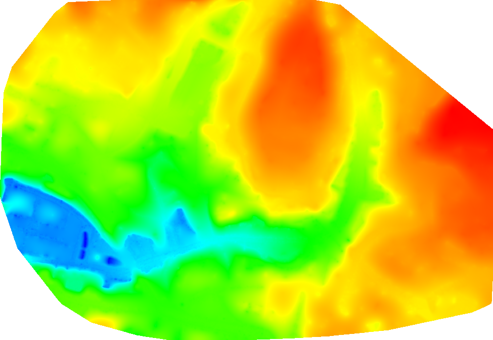
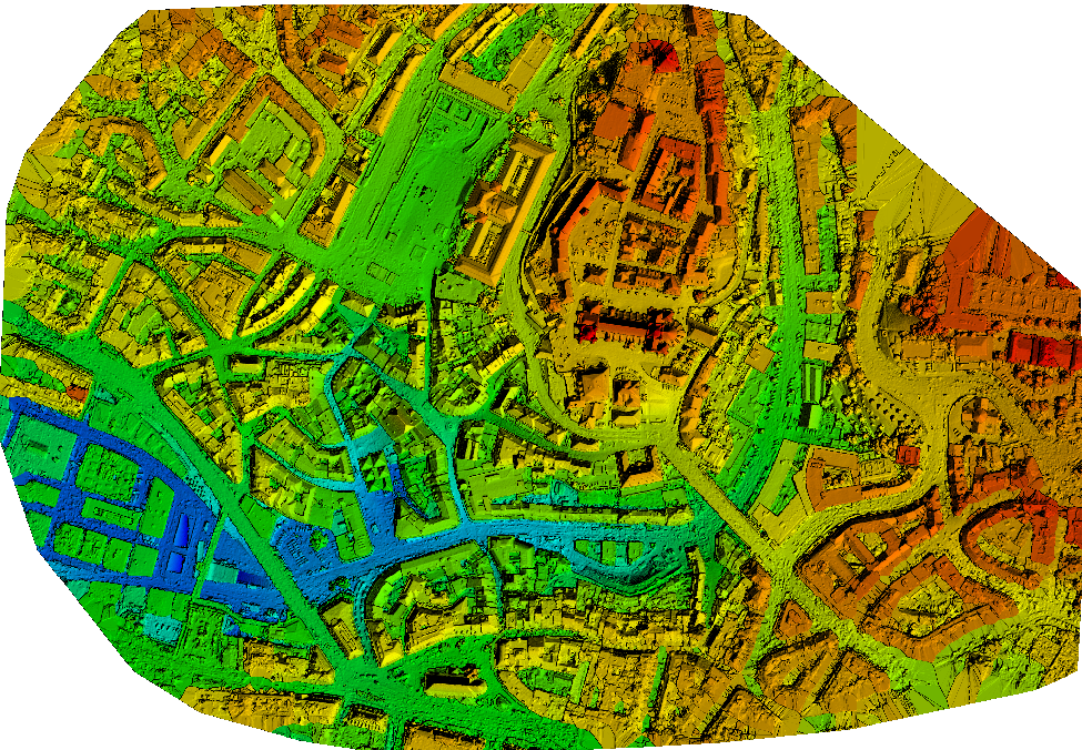
Raster DSM of the center of the city of Lausanne | Raster DTM of the center of the city of Lausanne |
I did not got the smooth results. In my case that did´nt work very well.
I still have many artefacts from buildings inside my DEM.
Shown in the following screenshots. How to solve this problems???
This is a project which was uploaded to the cloud. follow this Link:
https://cloud.pix4d.com/pro/project/401184/map?shareToken=147e50d1-452a-4dd8-b388-5bb6ac3041d4
Hallo Christian,
During DTM generation, the disabled points are not definitively removed but rather smoothed which can lead sometimes to certain inconsistencies. Besides as the classification is automatic it might need some manual correction.
That's why sometimes we would recommend to generate the DTM in the same way you do so for the DSM, but assigning all point from all classes, except "Ground" and "Road Surface", to the class "Disable". This usually leads to better results.
If you want to preserve some features, you can keep them by assigning them to the class "Ground". Make sure that all the points from features you want to preserve are assign to the correct class.
Then, when you are happy with your classification, you can launch step 3:
Make sure that Raster DTM is unchecked:

One more thing, if you DTM has some holes you can fill them using the "New Surface" tool:
Make sure that you have check the box "Use for DSM and Triangle Mesh":

Hope this will you to improve the quality for your DTM.
Best,
Thanks o lot
Hi, Marco:
We are working in agriculture and trying to create the DTM from point cloud. However, the soil/ground and (short) plants (< 2m) were always grouped in "Unclassified". Our site (as shown below) is not a typical landscape you used to train the classification model. I manually labeled (editted) some of the point cloud as plants (plants as a new group or Disable) and soil/ground, respectively, and run the Point Cloud Classification again. Point cloud belonging to plants were either grounped in ground or road surface, but not grouped as plants or Disable.
Any suggestion to improve the Point Cloud Classificaiton or DTM accuracy?
Thank you!
Source
In such situation result is much better without classifying
Would be useful to test in former release (ie before 4 release)
Regards
Can I generate DTM from DEM??
Please inform me
Yes, of course. Actually you have to ;-)
As written in the instruction above:
Step 3.
Remember:
Best
Hi Pix4d team, not sure if this is the appropriate platform but do you consider the DTM and DEM to be the same in the software? My understanding is that a DTM shows breaklines where a DEM does not, so can I use the DTM in stream delineation analyses in GIS software or is this not advisable?
Thanks
Hi Francois,
Indeed, you should use the DTM output with contour lines in the third party software for the stream delineation analyses as in that case you will analyse just the terrain without other environmental objects such as buildings, vegetation or roads. ;-)
Best
Buenas
He realizado los pasos como lo explica Marcos y los resultados que me arroja del DTM no se corresponden con la clasificación de nube de puntos del "Ground" y "Road Surface"( Realizada manual después de la obtenida por el programa) , en cambio exporto la clasificación de las nube de puntos del "Ground" y "Road Surface" a otro software y lo realiza correctamente.
Saludos y Gracias.
Buenas
Deberían permitir introducir los valores del GSD por debajo de los 5 cm/píxel. cuando se genere el DTM , lo mínimo que puedo procesar un DTM en el software es de 5 cm/pixel esto quiere decir que mi precision vertical sera de 15 cm, porque hasta donde sabemos la precision vertical es 3 veces el GSD. OJO si genero un DTM con los valores recomendado que es 5 veces el Gsd original esto dispararía la precisión vertical a valores muy alto. Ejemplo : Tengo un GSD original de 2 cm/píxel, mi GSD al Final de Procesar el DTM seria de 2*5=10 cm/píxel lo que me representaría un error estimado de 30 cm en la vertical.
Hola GREVER ERNESTO BROCH DE JESUS,
Hemos investigado que si la resolución es inferior a 5 veces la GSD las salidas serán demasiado ruidosas y en términos de líneas de contorno, por ejemplo, no nos da ninguna información importante. Como solución, se podría asignar puntos del grupo de Alta Vegetación, Edificio, Objeto Fabricado por el Hombre a la categoría "Disabled" y ejecutar el Paso 3 para obtener el DSM que en realidad sería su DTM con 1 x GSD.
Saludos
Hola
El proceso del DTM lo he realizado varias veces como recomiendas y me arroja el mismo resultado.
Hola GREVER ERNESTO BROCH DE JESUS,
¿Qué método estás usando?
Arriba he descrito cómo crear un DTM suavizando un DSM. Por lo tanto, si lo has seguido, tus resultados son el DSM. (Por eso si también has seleccionado el DTM, no se verá afectado por los cambios).
Luego, en cuanto a la resolución del DTM se puede configurarla en 1x GSD.
Si no funciona, necesitaría su informe de calidad para entender qué es lo que no funciona en su proyecto.
Saludos
Dear Pix4D Team,
I am the beginner who just start dealing with photogrammetry with this software.
I want to build a DEM with the image I took by drone Mavic 2 pro. I follow the step in the video, but there's no option "raster DYM" for me in the step three additional output. Do you know what could be the problem?
Thanks in advance!
Liang
Hi Liang, here you can find the processing options
If you cannot see any of these options, please share a screenshot with us.
Hi,
Thank you for your replay!
So this is my screenshot.
As you can see there's neither directly option for Grid DTM nor contour based on DTM.
I found create DTM option in the menu bar, but still I cannot create a contour based on DTM
Thanks~
Hello,
I believe you are using a quite old version of Pix4Dmapper. It also seems to be a macOS version that is not officially supported. Please try to download the latest windows version and let us know if the error persists.
Good day, ma’am/sir!
My study is all about “Tree Height Estimation using UAV and Photogrammetric 3D Point Clouds”. Is it possible to classify the Photogrammetric 3D Point Clouds derived from UAV to (ground, vegetation, and buildings)? I also want to generate DSM and DTM.
If not possible, can I use a DTM Lidar data as a reference? And is it possible to get a Canopy Height Model (CHM) from subtracting the SfM-DSM and DTM-Lidar using Pix4dMapper? Thank you very much, sir.
Hello Marie,
It is an interesting topic! Regarding the classification, you can follow the steps described in How to generate the point cloud classification and generate it. If the results need to be improved, you can use the edit the point cloud tool. For more information, please visit How to edit the point cloud in the rayCloud. Editing the point cloud allows to clean the 3D model by reducing noise and improving the precision as well as the visual rendering.
Warm regards,