In order to export Manual Tie Points and / or GCPs (option available if at least one Manual Tie Point or GCP exists in the project):
1. On the Menu bar, click View > rayCloud.
2. On the left sidebar, in the Layers section, right click on GCPs/MTPs.
3. Click Export Points..., the Export pop-up appears:
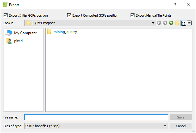
4. Navigate to the path where the points will be saved.
5. On File name, type the desired file name.
6. (optional) On Save as type by default ESRI Shapefiles (*.shp) is selected; to change to another output format: click ESRI Shapefiles (*.shp) and select the desired format, the following options appear:
- ESRI Shapefiles (*.shp)
- AutoCad DXF (*.dxf)
- Keyhole Markup Language (*.kml)
- Microstation DGN (*.dgn)
7. (optional) By default the initial and computed GCP positions and the Manual Tie Points are enabled. Unselect any of the check boxes to not export the initial, computed GCP positions and / or the Manual Tie Points.
8. Click Save.