This article provides descriptions of each button in the GCP/MTP Table within the GCP/MTP Manager.
Access: On the Menu bar, click
Project > GCP/MTP Manager...
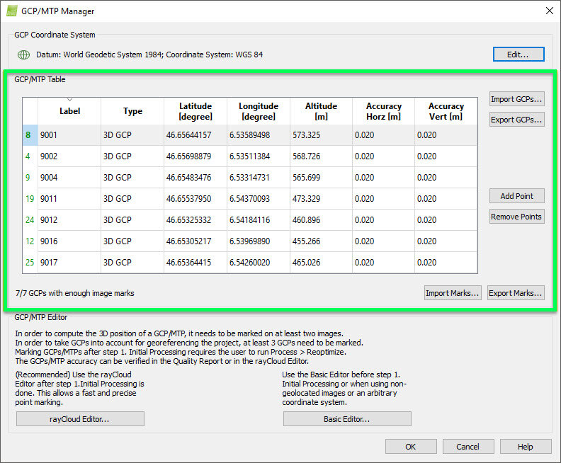
This section contains a GCP/MTP Table that displays all the GCPs/MTPs/Check Points of the projects together with their properties and 6 action buttons:
- Import GCPs...: Allows the user to import a file with GCPs/Check points.
- Export GCPs...: Allows the user to export GCPs/Check Points coordinates and, optionally for GCPs, the accuracy of the coordinates.
- Add Point: Allows the user to manually add one by one GCPs/MTPs/Check Points.
- Remove Points: Allows the user to remove the selected GCPs/MTPs/Check Points.
- Import Marks...: Allows the user to import a file that contains, for each GCPs/MTPs/Check Points list of the marked images and, for each image, the coordinates and zoom level.
- Export Marks...: Allows the user to export a file which contains, for each GCPs/MTPs/Check Points list of the marked images and, for each image, the coordinates and zoom level.
In the bottom left side, a status text appears indicating how many GCPs are implemented in the project and marked in at least 2 images.